SeaNav US
SeaNav US Summary
SeaNav US is a with in-app purchases iOS app in Maps And Navigation by Pocket Mariner Ltd.. Released in Apr 2013 (13 years ago). It has 100 ratings with a 4.32★ (good) average. Based on AppGoblin estimates, it reaches roughly 264 monthly active users and generates around $<10K monthly revenue (100% IAP / 0% ads). Store last updated Jun 1, 2026
Recent activity: 1.00 new ratings this week View trends →
SeaNav US SDKs Summary
App not yet scanned for SDKs.
4.32★
Ratings: 100
Screenshots
App Description
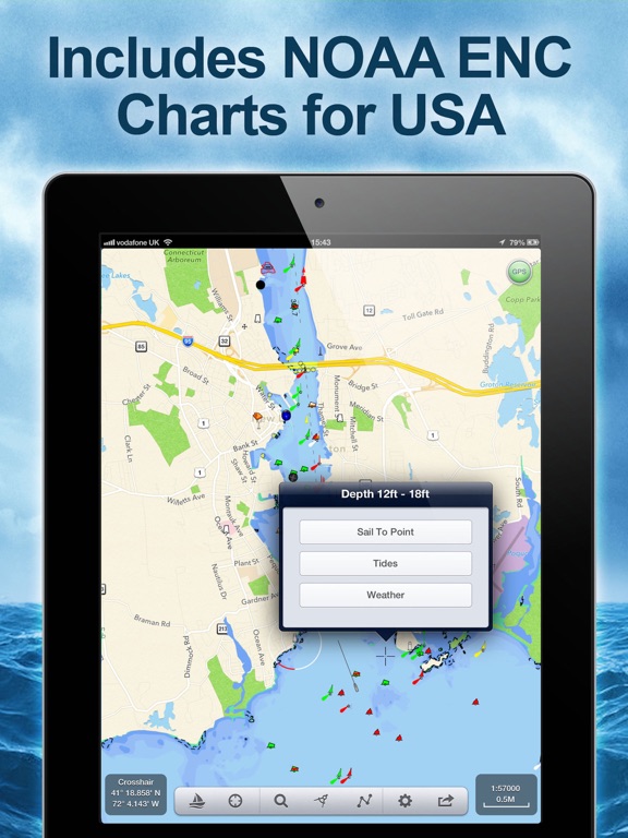
Explore, Plan and Navigate your boating trips in real time and outstanding high-resolution with the latest NOAA Marine charts covering the USA and US Great Lakes.
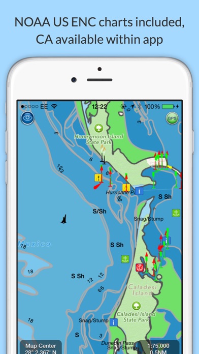
- Includes all US Coastal, ICW, Inland (USACE) and Great Lakes Digital Vector Charts
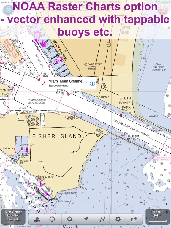
- Buoys, lights etc. are tappable with bearing and distance
- Free Apple Watch app
- Live AIS Ship targets and collision alerts (requires Boat Beacon)
- Seamless panning and zooming across charts
- Unique live Augmented Reality camera view
- Route Planning and tracking with Waypoints, ETA, XTE, etc. plus SeaNav autorouting
- Offline charts
- Route export and import to MFDs and other apps via gpx
- ActiveCaptain Marinas, Anchorage, Hazards and reviews
- US NOAA Raster charts available via IAP
- Canadian charts via IAP
- British Virgin Islands & Bermuda charts via IAP
- External NMEA over Wifi
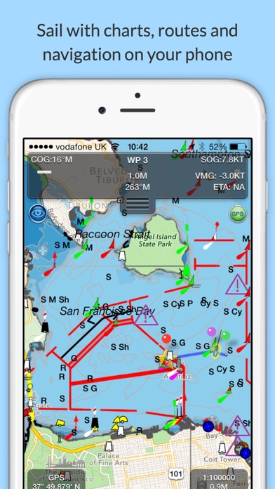
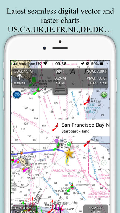
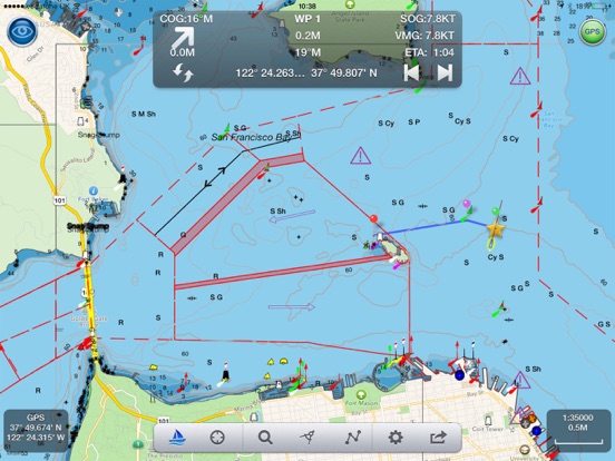
SeaNav uses Digital Vector charts providing a wealth of benefits and advantages. Buoys, Lights, Bridges, Depth Contours, Depth Soundings, Rocks, Anchorage areas, NOAA Weather Buoys etc. are all selectable and have real time distance, bearing and detail information. Turn off layers to de-clutter the display and only show what is important at the time. Tides, moon and sun times and weather are also all available at your fingertips.
SeaNav’s unique AR view mode allows you to view buoys, lights, ships, waypoints and track overlaid on your iPhone or iPad live camera view. With "AR LockOn" you can select a target on the chart and then be guided to it in the AR camera view.
SeaNav lets you measure distances and bearings and record waypoints on routes. When at sea, the app’s Sailing HUD shows your position, Course over ground (COG), Speed over ground (SOG), Vector Made Good (VMG), Estimated Time of Arrival (ETA), Distance and bearing to next Waypoint. Waypoint reached alerts, auto-routing to the next waypoint and collision alerts.
SeaNav comes with a free Apple Watch companion app .
Lowrance, Simrad and B&G GoFree support included.
Your purchase of SeaNav includes 12 months of free updates to the included US chart set. Further chart updates are then available via an in-app purchase. Charts for other regions including Canada may also be added to your product via optional in-app purchase.
Our in-app purchases are 1 year subscriptions, which automatically renew at the end of the subscription period unless auto-renew is turne