SeaNav UK & Ireland
SeaNav UK & Ireland Summary
SeaNav UK & Ireland is a with in-app purchases iOS app in Maps And Navigation by Pocket Mariner Ltd.. Released in Apr 2013 (13 years ago). It has 1.00 ratings with a 3.00★ (mixed) average. Based on AppGoblin estimates, it reaches roughly 1.00 monthly active users and generates around $<10K monthly revenue (100% IAP / 0% ads). Store last updated Jun 2, 2026
SeaNav UK & Ireland SDKs Summary
App not yet scanned for SDKs.
3★
Ratings: 1.00
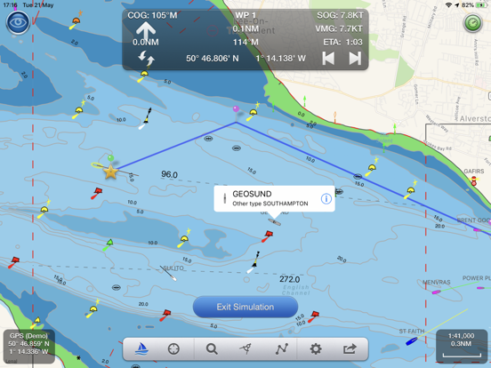
Screenshots
App Description
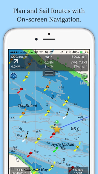
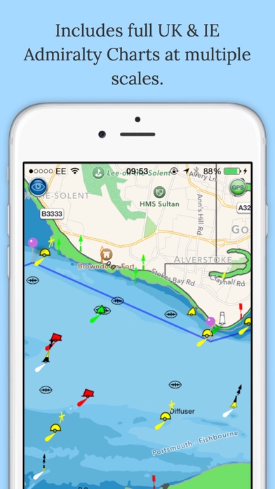
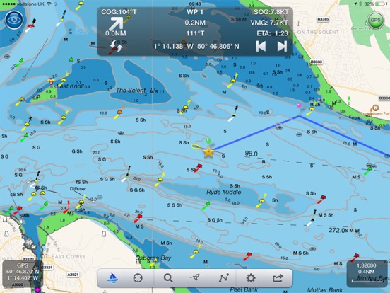
Explore, Plan and Navigate your boating trips in real time and outstanding high-resolution with the latest Digital Vector Marine charts derived from UKHO data covering the whole of the UK and Ireland.
- Price includes all UK & IE Charts, tides and tidal streams
- European & BVI charts available (IAP)
- Free compandion Apple Watch app
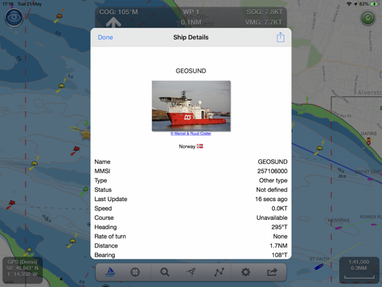
- Live AIS Ship positions with colour coded ship icons and collision alerts - requires Boat Beacon
- Live Augmented Reality camera view
- Route Planning and real time tracking including auto-routing
- Autopilot support for Raymarine and Navico autohelms
- Seamless panning and zoom across charts
- North and course up displays
- Offline Charts
- Route import and sharing to MFDs and other apps via gpx
- Favourite Places
- Air Draft: Check your boat's clearance under bridges and cables
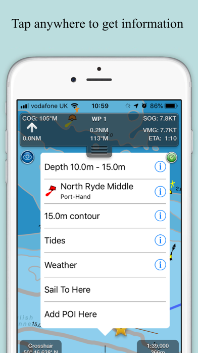
SeaNav uses the latest Digital Vector charts providing a wealth of benefits and advantages over traditional raster charts. Buoys, Lights, Bridges, Depth Contours, Depth Soundings, Rocks, Anchorage areas etc. are all selectable and have real time distance, bearing and detail information. Tides, moon and sun times and weather are also all available at your fingertips.
Our unique AR view mode allows you to view buoys, lights, ships, waypoints and track overlaid on your iPhone or iPad live camera view. With "AR LockOn" you can select a target on the chart and then be guided to it in the AR camera view.
In-app tools let you measure distances and bearings and record waypoints on routes to sail. When you are out at sea, the app’s Sailing HUD shows your position on the route, Course over ground (COG), Speed over ground (SOG), Vector Made Good (VMG), Estimated Time of Arrival (ETA), Distance and bearing to next Waypoint. Waypoint reached alerts, auto-routing to the next waypoint and flashing collision alerts (with Boat Beacon).
External NMEA support for AIS, Autopilot, Wind and Depth
Requirements:
iPhone or iPad. Optional Real time AIS, Tides and Weather information require an active internet connection.
Real-time route navigation requires a GPS location. iPhone devices and iPads with a cellular modem already have a built-in GPS, even if they do not have an active service plan. If you have a WiFi-only iPad you will need an external GPS receiver or feed to enable navigation.
Your purchase of SeaNav includes 12 months free updates to the included