Mobile Data Collection
Mobile Data Collection Summary
Mobile Data Collection is a with in-app purchases iOS app in Productivity by GIS Cloud Inc.. Released in May 2013 (13 years ago). It has 73 ratings with a 4.56★ (excellent) average. Based on AppGoblin estimates, it reaches roughly 294 monthly active users and generates around $<10K monthly revenue (100% IAP / 0% ads). Store metadata: updated May 5, 2026.
Store info: Last updated on App Store on May 5, 2026 .
4.56★
Ratings: 73
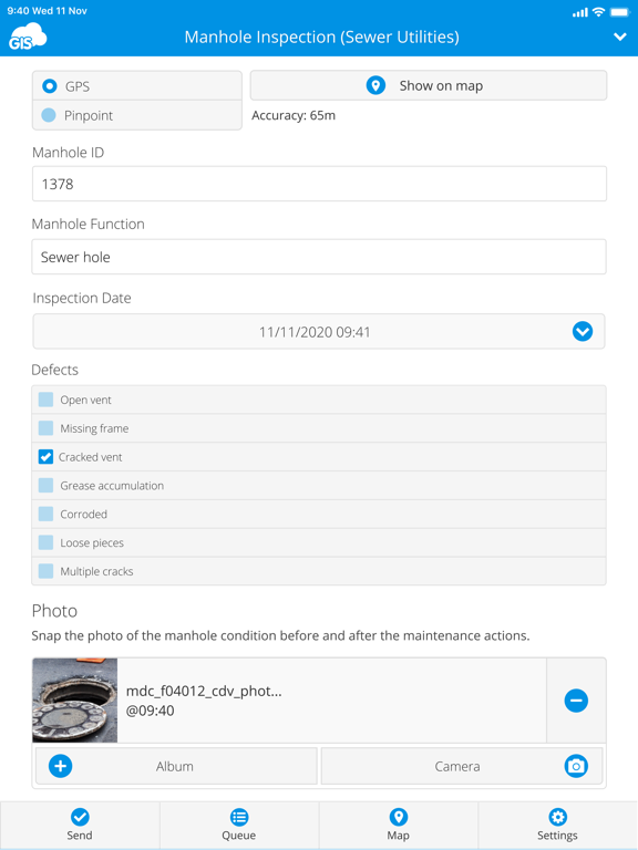
Screenshots

App Description
GIS Cloud Mobile Data Collection is a solution for recording and updating data in the field with mobile devices in real time, also allowing instant data access from the office. Digitize your workflow and eliminate errors and time-consuming paperwork!
The mobile app enables you to accurately record data, online or offline, by filling in digital custom survey forms. You can create an unlimited number of your own unique forms in the user-friendly form builder, in the connected web app (Mobile Data Collection Portal).
Continue working on your data, edit, share, and collaborate through GIS Cloud powerful web Map Editor app. Find everything you need for your workflow in one platform, no need for integrations.
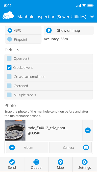
Collect points, lines, or polygons! Use GPS to capture data on the go, or switch to manual and use pinpoint and drawing tools for even better precision.
Form fields are fully customizable and you can choose from text fields, selects lists, radio buttons, checkboxes, electronic signature, autofill, barcode, photo and audio, hidden fields, and much more. To control data accuracy and eliminate errors, make your form fields required, conditional (dependent on other form fields or data input), or persistent.
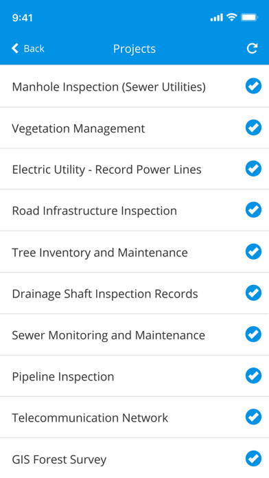
Manage your field staff and share projects with custom forms to field workers by assigning them the collect and update permissions, and they can instantly start collecting data in the field.
Simply sign into your GIS Cloud account (or sign up for free) and send collected data directly to your GIS Cloud app in the cloud. Data is immediately represented on a map, just click on any map feature to access collected data. Generate reports from the web app.
Access data through GIS Cloud Map Editor, where you can further edit and style your data, overlay with additional data layers analyze data, share data with colleagues with different permissions to collaborate on projects. You can also export data and much more.
Collect field data and conduct field surveys faster and easier than ever before. Start creating forms in the MDC Portal web app on https://giscloud.com and have your team out and about in a quarter of an hour!
All you need in the field:
- Offline data capture
- Offline maps
- Points, Lines, and Polygons geometry support
- Media (photos & audio) enriched location information
- QR code and barcode support
- Electronic signature
- Dropdowns, list