Yosemite Pocket Maps
Yosemite Pocket Maps Summary
Yosemite Pocket Maps is a ad-supported, with in-app purchases iOS app in Travel And Local by Alex Gugel. Released in Oct 2022 (3 years ago). It has 8.00 ratings with a 5.00★ (excellent) average. Based on AppGoblin estimates, it reaches roughly 9.00 monthly active users and generates around $<10K monthly revenue (27% IAP / 73% ads). Store metadata: updated May 6, 2026.
Store info: Last updated on App Store on May 6, 2026 .
5★
Ratings: 8.00
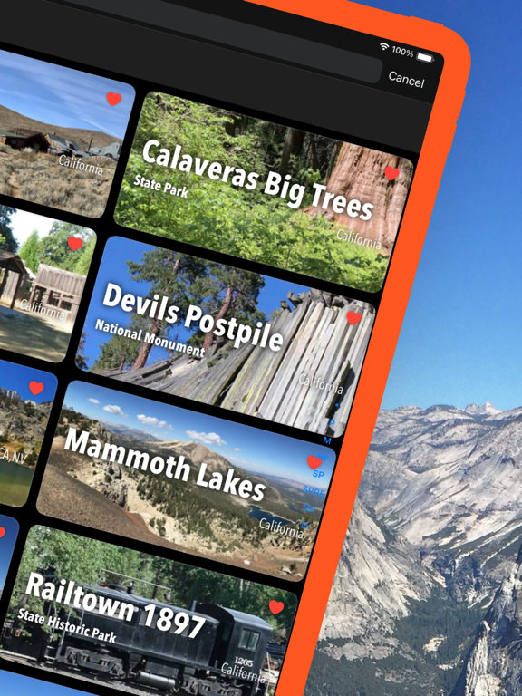
Screenshots


App Description
Be prepared! Plan your next trip to the Yosemite national park area. Download maps and guides before you venture into the Wi-Fi free wilderness.
Discover
- 15+ national parks, state parks, monuments, forests
- 110+ neatly folded maps by the National Park Service, Bureau of Land Management, United States Forest Services, and other agencies.
- Complete USGS 7.5 minutes topo maps coverage for Yosemite National Park and Devils Postpile National Monument.
- Motor Vehicle Use Maps (MVUM), Motor Vehicle Travel Maps (MVTM) and visitor maps for national forests.
- 2,200+ campgrounds and campsites
- 2,100+ trails and trailheads
- 150,000+ points of interests
Plan
- Download maps, park brochures, and newspapers. These downloads are ready when you are offline and off the grid in the great outdoors.
- Download arbitrary map sections as offline packs.
- Photo galleries, panorama views.
- Share links to parks and maps with friends
Have fun
- GPS and GPX support: record your hikes, import GPX routes, tracks and waypoints for your hiking trails.
- Detailed national park information: alerts, news, visitor centers, campgrounds, driving directions, weather.
- Open your favorite maps app to get a route to the selected park.
- Current weather conditions, easy access to multi-day forecasts, sunrise and sunset times.
- Push notifications for park alerts, park news, weather warnings
So download maps and guides for:
National Parks
- Yosemite National Park
- Devils Postpile National Monument
National Forests
- Humboldt-Toiyabe
- Inyo
- Sierra
- Stanislaus
State Parks and other areas
- Bodie
- Calaveras Big Trees
- California State Mining and Mineral Museum
- Columbia
- Grover Hot Springs
- Mammoth Lakes
- Mono Lake Tufa
- Railtown 1897
- Wassama Round House
-
GPS
- Continued use of GPS running in the background can dramatically decrease battery life.
LEGAL
Terms of Use: https://www.icoat.de/pocketmaps/terms
Privacy Policy: https://www.icoat.de/pocketmaps/privacy