GLand: GPS Field Area Measure
GLand: GPS Field Area Measure Summary
GLand: GPS Field Area Measure is a ad-supported, with in-app purchases iOS app in Tools by Authai Yaprasat. Released in Nov 2022 (3 years ago). It has 14.9K ratings with a 4.72★ (excellent) average. Based on AppGoblin estimates, it reaches roughly 55.3K monthly active users and generates around $<10K monthly revenue (46% IAP / 54% ads). Store metadata: updated May 7, 2026, version 73.
Recent activity: 4.00 new ratings this week View trends →
Data tracking: SDKs and third-party integrations were last analyzed on May 18, 2026.
Store info: Last updated on App Store on May 7, 2026 (version 73).
SDKs, Trackers & Permissions
GLand: GPS Field Area Measure was last scanned for SDKs 2026-05-18. Below is the overview of third party companies detected in the app. The full list of raw SDKs, app permissions and unknown SDKs is available here.
App Details
App Store
Ads & App-Ads.txt
AppGoblin SDK Scans
4.72★
Ratings: 14.9K
Screenshots


App Description
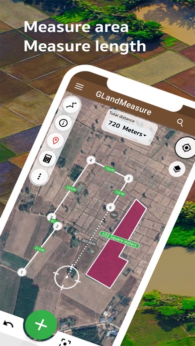
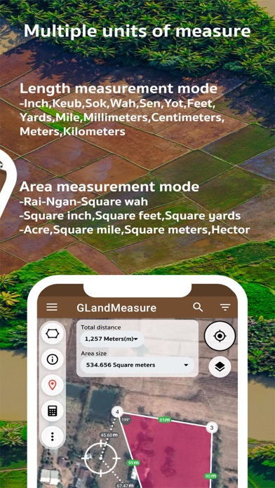
GLandMeasure is a free app for measuring areas and lengths that can be used to measure land, farm, field, home, distance, and length measurement easily. With the method of pinning on the map Or use the actual walking method Which the app will calculate the area And length automatically You can also choose from several types of measurement units. And can also be able to easily share images of the area Just a few steps
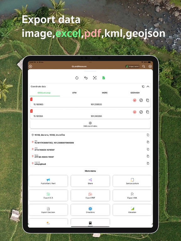
It covers the use of people who work in real estate as well. Including farmers who want to use it, it is considered an answer. After measuring the area, you can export your coordinates in a variety of formats, such as land sales announcements. Real Estate Society, PDF, Excel, KML, Geojson, map photos, route finder, elevation, soil cue calculations, tree counts in area, weather forecasts, calculations and cameras.
Support various tools compass tool convert measurement units Coordinate unit converter GEO(Lat Long) UTM MGRS Geojson geographic camera
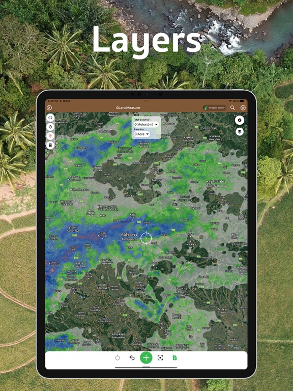
Supports multiple layers: WMS, XYZ Tiles, Image Layers, Current Rain Layers.
Support to create multiple projects
Support for displaying large amounts of data
Terms of Use: https://www.apple.com/legal/internet-services/itunes/dev/stdeula/