GPS Navigation & Live Map
GPS Navigation & Live Map Summary
GPS Navigation & Live Map is a ad-supported, with in-app purchases iOS app in Maps And Navigation by Amit Lakhani. Released in Nov 2022 (3 years ago). It has 1.5K ratings with a 4.42★ (good) average. Based on AppGoblin estimates, it reaches roughly 6.1K monthly active users and generates around $<10K monthly revenue (45% IAP / 55% ads). Store metadata: updated Sep 28, 2025, version 1.
Recent activity: 13 new ratings this week View trends →
Data tracking: SDKs and third-party integrations were last analyzed on May 15, 2026.
Store info: Last updated on App Store on Sep 28, 2025 (version 1).
SDKs, Trackers & Permissions
GPS Navigation & Live Map was last scanned for SDKs 2026-05-15. Below is the overview of third party companies detected in the app. The full list of raw SDKs, app permissions and unknown SDKs is available here.
App Details
App Store
Ads & App-Ads.txt
AppGoblin SDK Scans
4.42★
Ratings: 1.5K
Screenshots


App Description
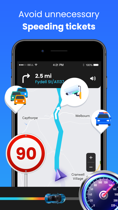
GPS Navigation with voice navigation, live map, traffic, offline Gps & direction.
GPS Navigation with voice navigation, live map, traffic, offline Gps & direction. Map GPS navigation route directions location live car driving satellite view. Maps is provide Flyover and 3D maps's map service to replace the Google Maps application on iOS devices.
Real-time GPS navigation & local suggestions for food, events, & activities. Sygic will provide you useful features: Google street view, offline+maps, gps tracker, location sharing, navigation maps, gps driving route and many more! GPS Maps tells you about directions, traffic, police, crashes & more.
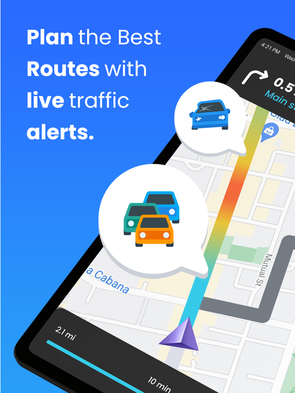
In GPS Navigation, You can find driving directions using GPS, Maps, Voice Navigation & Directions App also can check Live traffic updates, voice navigation, find location, weather & transit info. GPS maps can help Live traffic updates, voice navigation, find location, Gps live location, whether & transit info.
Get there faster with real-time updates:
• Maps - Navigate & Explore
• Navigation for Google Maps Go
• GPS, Maps, Traffic Alerts & Live Navigation
• GPS, Maps, Voice Navigation & Directions
• GPS Live Navigation, Maps, Directions and Explore
GPS Maps and Directions main features:
• REAL-TIME MAPS
• MAPS & LIVE NAVIGATION
• TRAFFIC ALERTS
• EXPLORE PLACES
• SUBWAY MAPS
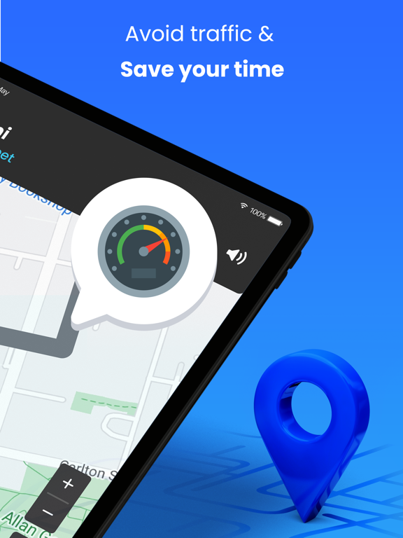
• SPEEDOMETER
• GPS TRACKER
• NAVIGATION
• STREETVIEW
• GPS MAP CAMERA
Why GPS Maps Navigation?
• Find Path: Truck GPS & Maps
• Maps - Transit & Food
• MapQuest GPS Navigation & Maps
• GPS MAP CAMERA
GPS location is maps an online service that builds custom maps based on OpenStreetMap. Waze is a web mapping and navigation service with street view map, radar detector, satellite map.
Directions and transit
Googlemap provides the best route planner with toll calculator gps navigation.
Traffic conditions
GPS navigation app offering traffic data on top of roads and motorways to represent the speed of vehicles on particular roads.GPS maps navigation show the speed with GPS speedometer and location information with GPS location, GPS navigation & city traffic show the traffic conditions on the gps maps.
Street view
Free apps GPS live navigation & maps providing 360° panoramic street-level views of various locations.
Offline Maps Navigation
GPS Navigation & City Traffic is a free speedometer, odometer and compas