NOAA Live Weather Radar・Alert
NOAA Live Weather Radar・Alert Summary
NOAA Live Weather Radar・Alert is a with in-app purchases iOS app in Weather by Tien Long Nguyen. Released in Jul 2023 (2 years ago). It has 815 ratings with a 4.81★ (excellent) average. Based on AppGoblin estimates, it reaches roughly 2.4K monthly active users and generates around $<10K monthly revenue (100% IAP / 0% ads). Store metadata: updated May 9, 2026, version 47.
Recent activity: 3.00 new ratings this week View trends →
Data tracking: SDKs and third-party integrations were last analyzed on Apr 27, 2026.
Store info: Last updated on App Store on May 9, 2026 (version 47).
NOAA Live Weather Radar・Alert was last scanned for SDKs 2026-04-27. Below is the overview of third party companies detected in the app. The full list of raw SDKs, app permissions and unknown SDKs is available here.
4.81★
Ratings: 815
Screenshots


App Description
Check the local weather forecast to get ready for today! Get timely alerts in case of severe weather. Follow weather patterns on the radar map or consult the charts.
*** NEW: TRIP WEATHER PLANNING***
Drive safer and know exactly what's ahead. Plan your road trips with real-time weather and radar checked mile-by-mile along your entire route. Automatically avoid severe conditions—never drive into a storm again!
Welcome to SkyFlip: NOAA Live Weather & Alert. This is the ultimate weather companion for all your outdoor adventures, daily commutes, and road trips! Get real-time weather updates straight from reliable sources, so you're always in the know about what's happening in your area.
RADAR MAP FEATURES:
• Trip Weather: Interactive timeline forecasts for your driving route.
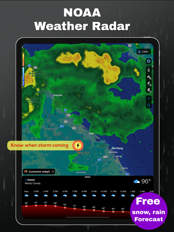
• Weather Radar Map: Track storms, rain, snow as they move across your region.
• Future Precipitation Radar: Understand what's coming down, be it rain, snow, or drizzle. Get prepared before the first drop lands.
• Global Temperature Radar: Whether the sun is shining or the snow is falling, stay informed and prepared with our 7-day global temperature forecast map.
• Snow Map: Strategize up to 14 days in advance with our color-coded Snow Depth Forecasts.
• Air Quality Map: Keep track of the AQI and monitor the levels of PM2.5, PM10, CO, SO2 and other air pollutants.
• Cloud Cover Map: See the clouds movement on the global map.
• Humidity Map
• Wind Map
TRACK EXTREME WEATHER EVENTS:
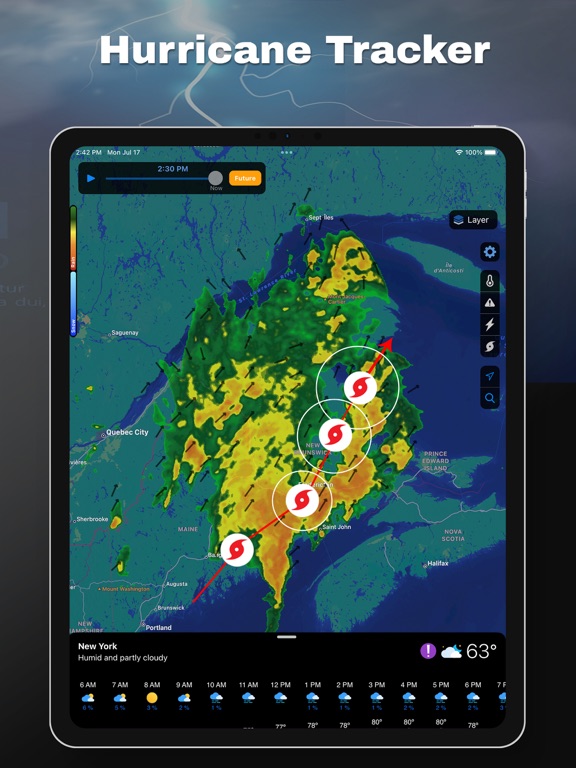
• Hurricane Tracker: Get precise hurricane path predictions! Monitor the storm’s current position and see its next move with ease.
• Real-Time Lightning Tracker: View the recent lightning strikes on the interactive map.
• Wildfire Tracker: Stay vigilant during fire-season. Track the progress of fires in real-time with satellite-based detection. Stay away from smoke with Air Quality Index details.
• Earthquake Tracker
WEATHER FORECAST:
• Dark Sky UI: Support full Dark Sky design so you can easily navigate through all necessary weather information.
• 10-Day Hourly Forecast: Get a precise weather forecast for the next 10 days, including hourly temperature, chance of precipitation, humidity, wind speed, visibility, and dew point.
• Daily Local Weather Forecast Details: Get the comprehensive details you need: chance of precipitation, precipitation amounts, UV Index, barometric p