Earthquake Monitor Live Map

Earthquake Monitor Live Map Summary
Earthquake Monitor Live Map is a free, with in-app purchases iOS app in Lifestyle by Igor Bidenko. Released in Dec 2025 (10 months ago). It has 2.00 ratings with a 5.00★ (excellent) average. Based on AppGoblin estimates, it reaches roughly 7.00 monthly active users and generates around $<10K monthly revenue (100% IAP / 0% ads). Store last updated Aug 25, 2026
Earthquake Monitor Live Map SDKs Summary
App not yet scanned for SDKs.
5★
Ratings: 2.00
Screenshots


App Description
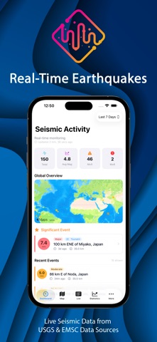
Earthquake Monitor shows you what the ground is doing, right now, anywhere in the world.
The data comes from the United States Geological Survey and the European-Mediterranean Seismological Centre, the same networks geologists and emergency services work from.
WATCH THE PLACES THAT MATTER
Save a location, choose a radius and a minimum magnitude, and every new earthquake is checked against it. When something crosses your threshold, you get a notification, including while the app is closed. Quakes at or above your critical magnitude arrive as Time Sensitive, so they cut through Focus modes and quiet hours. Everything below that threshold comes through quietly. You can set quiet hours of your own and still let the serious ones in.
Your location is read once, when you place an alert. It stays on the device. No account, no sign-up, no server holding your data.
SEE EVERYTHING
• A world map that stays smooth with thousands of events on it. Events group into clusters as you zoom out and split apart as you zoom in, and tapping a cluster tells you exactly what is inside it. Colour follows magnitude, so a glance is enough.
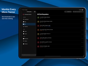
• The full list, with magnitude, depth, distance from you, local time and the USGS event page one tap away. Copy the details or share an event without leaving the screen.
• Filter by timeframe and by magnitude, search by place, and bookmark anything worth keeping.
• Statistics that go past the headline number: magnitude distribution, depth profile and how activity moved over the period you are looking at.
• USGS and EMSC side by side, so you can see where the two networks disagree on the same quake and by how much.
LEARN
Plain explanations of magnitude scales, depth zones, seismic wave types and the major tectonic plates, written for people who are curious rather than qualified. There is also a browsable catalogue of the largest earthquakes since 1900, with what each one changed about how we build and warn.
WHAT IS FREE
The live map, the full event view, the complete list, the last hour and the last 24 hours, and one watched location with alerts. Most apps in this category lock the map or the details behind a purchase. This one does not.
WHAT PRO ADDS
• Unlimited watched locations
• Seven days of history and the significant-quake feed
• Statistics and analytics
• EMSC alongside USGS, with side-by-side source comparison
• Ma