Japan Alerts

Japan Alerts Summary
Japan Alerts is a free, ad-supported, with in-app purchases iOS app in Weather by Itchigoo. Released in Mar 2026 (7 months ago). It has 24 ratings with a 4.21★ (good) average. Based on AppGoblin estimates, it reaches roughly 160 monthly active users and generates around $<10K monthly revenue (59% IAP / 41% ads). Store last updated Sep 28, 2026
Recent activity: 2.00 new ratings this week View trends →
Japan Alerts SDKs Summary
App not yet scanned for SDKs.
4.21★
Ratings: 24
Screenshots

App Description
Japan Alerts delivers real-time earthquake, tsunami, volcano, typhoon, and all kinds of evacuation alerts from the Japan Meteorological Agency (JMA), translated into 12 languages.
WHO IS THIS APP FOR?
- Residents and expats who need alerts in their own language
- Travelers — add your destinations (up to 6 in Premium) and arrive prepared
- Anyone with family or a loved one in Japan
- Families who want a shared earthquake safety plan
- Anyone fascinated by Japanese seismology and volcanology
REAL-TIME ALERTS
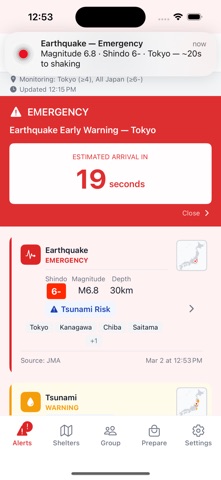
- Earthquake alerts with Shindo intensity and magnitude
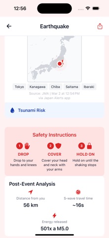
- S-wave countdown on emergency alerts: how many seconds before the shaking reaches you
- Tsunami warnings with expected wave height and affected coastline
- Municipality-level evacuation orders for every hazard — floods, landslides, storm surge and more — by warning level, in plain language
- Volcanic eruption bulletins, typhoon tracking and severe-weather alerts
10 LANGUAGES
Not just the app: alerts and place names are translated — nothing vital stays in Japanese only. Note: shelter names, addresses and place names are provided in English and/or romaji, not in the app language. Available in English, Japanese, French, Chinese, Korean, German, Spanish, Italian, Portuguese, and Russian.
FREE — THE SAFETY ESSENTIALS
- Alerts for moderate quakes (Shindo 4+) near you, and strong quakes (Shindo 6-) anywhere in Japan
- 98,000+ official evacuation shelters with names and addresses in English/romaji, plus walking directions and offline access
- Interactive map: epicenters, affected areas, and shelters (earthquake, tsunami, flood, fire)
- A family safety group, "I'm safe" check-in, and a shared map
- 100 years of seismic history in an animated time-lapse, plus statistics
- Distinct, customizable alert sounds and a quiet night mode
PREMIUM — GO DEEPER
- Watch up to 7 places at once: your home plus 6 custom zones anywhere in Japan
- Set your own Shindo threshold per zone — be alerted before it gets serious
- Hazard maps across all 47 prefectures: flood, tsunami, landslide, liquefaction, volcanic and more (free: your home prefecture, one hazard type only)
- No ads
- Traveling to Osaka next month? Add it as a zone before you go.
INTERACTIVE MAP & SHELTERS
- Epicenters, affected areas, hazard layers and volcanoes at a glance
- Filter shelters by type: earthquake, tsunami,