WindTrac: Wind, Wave & Storm

WindTrac: Wind, Wave & Storm Summary
WindTrac: Wind, Wave & Storm is a free, with in-app purchases iOS app in Weather by Rivolu LLC. Released in Jun 2026 (3 months ago). It has 1.00 ratings with a 5.00★ (excellent) average. Based on AppGoblin estimates, it reaches roughly 5.00 monthly active users and generates around $<10K monthly revenue (100% IAP / 0% ads). Store last updated Aug 10, 2026
WindTrac: Wind, Wave & Storm SDKs Summary
App not yet scanned for SDKs.
5★
Ratings: 1.00
Screenshots


App Description
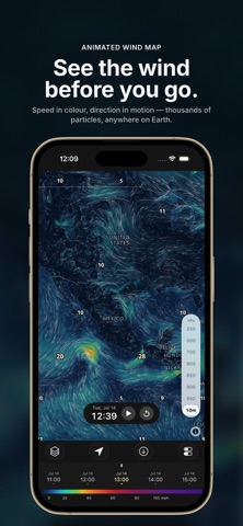
WindTrac is a weather app that turns raw data into a living, animated map you can read at a glance. Tens of thousands of particles stream along the wind field — speed as colour, direction as motion — for a clear, beautiful picture of the moving air anywhere on Earth, from your coast to the open ocean.
WindTrac is built for sailors, kitesurfers, windsurfers, surfers, paraglider pilots, fishermen, boaters, hikers, photographers, and anyone who plans a day around the weather.
Five weather layers, animated
Wind streams as glowing particles across the whole globe. Waves show significant wave height as a colour heatmap with wave direction and period. Precipitation paints rain and snow intensity frame by frame so you can watch systems come and go. Cloud cover shows the low cloud that actually blocks the sun. Temperature gives 2 m air temperature in °C or °F.
Wind At Every Altitude
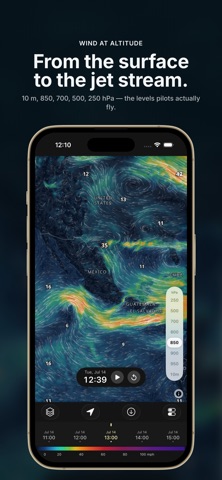
Read the wind from 10 m at the surface up through the 850, 700, 500 and 250 hPa pressure levels — the whole column from a paraglider launch to the jet stream, on one slider.
Time You Can Scrub
Every layer is time-animated. Drag the timeline to any forecast hour or press play, with smooth transitions and speeds from 1× to 8×, and watch a multi-day weather system unfold in seconds.
Tap anywhere on the map to read the exact wind speed, wave height or temperature — the notable highs and lows are labelled automatically. Save favourite spots and jump straight to them. Show times in your device zone, the viewed location's zone, or UTC.
Storm Watch — official alerts and hurricane tracking
Live watches, warnings and advisories from the US National Weather Service and Environment Canada, drawn on the map where they apply. Tap any alert for the full official text.
Track tropical storms and hurricanes with the National Hurricane Center's forecast cone, track and 34-knot wind field — and because the wind field moves with the timeline, you can see when tropical-storm-force wind is forecast to reach you. Areas being watched for development are shown too, along with observed tornado, wind and hail reports from the past 24 hours.
All of it is free, and any of it can be switched off.
Multiple professional forecast models
WindTrac is built on public data from the world's leading weather centres, and lets you pick the model per layer: NOAA GFS (global), NOAA GEFS ensemble mean,