FieldTap: Field Data Capture

FieldTap: Field Data Capture Summary
FieldTap: Field Data Capture is a free iOS app in Business by Benjamin Hinton. Released in Aug 2026 (1 month ago). Store last updated Aug 31, 2026
FieldTap: Field Data Capture SDKs Summary
App not yet scanned for SDKs.
0★
Ratings: 0
Screenshots




App Description
FieldTap is the offline-first field data app for teams who work where the signal doesn't. Capture records, photos, GPS points and map data anywhere—then let everything sync automatically the moment you're back online. No lost work, no "save for later," no dead zones.
START FROM THE FORM YOU ALREADY USE
• Upload a fillable agency PDF—FieldTap reads its fields and builds a matching digital form for you, in the order they appear on the page, keeping the printed question numbers
• The export mapping is built at the same time, so your field data flows back onto that exact PDF, ready to submit
• Or design your own from scratch, or start from the template library
WORKS OFFLINE, BY DESIGN
• Collect data with zero connectivity—forms, photos, sketches and GPS all work offline
• Records sync automatically and conflict-free when you reconnect
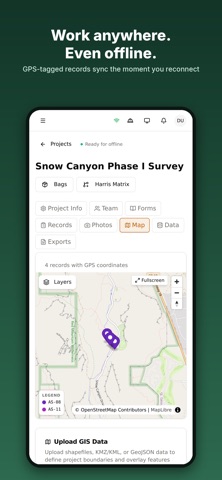
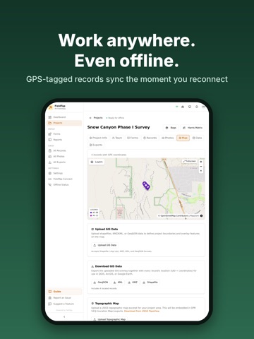
• Cached basemaps and tiles keep your project map usable in the backcountry
• An Offline Status screen tells you exactly what's ready before you lose signal
FORMS BUILT FOR THE FIELD
• Any protocol: shovel tests, site records, inspections, monitoring logs and more
• Repeatable groups and tables, calculated fields, headings, conditional logic, photo capture and signatures
• Sticky section navigation and a full-screen preview so long forms stay usable
• Long-text fields open in a distraction-free editor
MAPS, GPS & GIS
• Drop GPS-tagged records and see them on an interactive project map
• Upload shapefiles, KML/KMZ and GeoJSON to overlay boundaries and features
• Layer controls, legends and full-screen field mode
PHOTOS & AI ASSIST
• Attach geotagged photos to any record, with a clear per-photo upload state
• Optional AI photo analysis and field-data summaries to speed up write-ups
EXPORT TO ANYTHING
• Fill your original fillable PDF, or generate an expandable PDF/Word document that mirrors your form's structure and grows to fit everything you recorded
• One-tap export to CSV, Excel, Word and GIS formats
• Combine several reports into a single download
• Filenames carry your record UID—ready to hand off
BUILT FOR CREWS
• Organize work by project and crew
• Two people recording the same site number? Their entries merge into one record, with every contribution reviewable
• Track record status from draft to submitted to approved
• Sort, filter and group on any column; table