GeoCam - GPS Map Camera

GeoCam - GPS Map Camera Summary
GeoCam - GPS Map Camera is a free iOS app in Photo And Video by Meetanshi Technologies LLP. Released in Jun 2026 (4 months ago). Store last updated Sep 24, 2026
GeoCam - GPS Map Camera SDKs Summary
App not yet scanned for SDKs.
0★
Ratings: 0
Screenshots
App Description
GeoCam: Your Professional GPS Map Camera
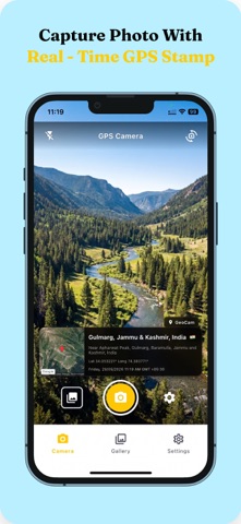
Transform your photography into location-verified documentation with GeoCam. Automatically overlay GPS coordinates (Latitude & Longitude), full street addresses, date, time, and a mini-satellite map directly onto your photos as you capture them.
WHO IS GEOCAM FOR?
GeoCam is an essential tool for professionals who need accurate location evidence:
• Civil Engineers & Construction Managers
• Real Estate Agents & Property Inspectors
• Field Workers & Surveyors
• Insurance Adjusters
• Travel Bloggers & Explorers
• Logistics & Delivery Teams
CORE FEATURES:
• Live GPS Stamping: View real-time coordinates on your camera preview.
• Automatic Reverse Geocoding: Get instant street addresses without manual entry.
• Satellite Map Preview: Embed a mini map tile on your photo for better context.
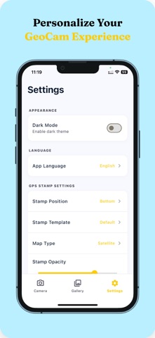
• Professional Templates: Choose from Default, Minimal, or Classic stamp designs.
• Complete Customization: Adjust stamp position, opacity, and photo quality.
• Multi-Language Support: Localized in English, Gujarati, Hindi, and more.
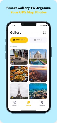
• Smart Gallery: Access GeoCam photos and device gallery in separate tabs.
• Dark Mode Support: Professional UI designed for all lighting conditions.
PRIVACY-FIRST DESIGN:
• No Account Required: Start using the app immediately without any registration.
• Local Storage: Your photos stay on your device. We do not upload data to any cloud.
• Anonymous Usage: We do not collect names, emails, or personal identifiers.
IDEAL FOR:
• Construction Site Reports
• Property Documentation
• Insurance Claims Evidence
• Travel Memories with Precise Location
• Delivery Verification
Download GeoCam today and streamline your field documentation with verified GPS data!