GPS Camera: Geolocation & Map

GPS Camera: Geolocation & Map Summary
GPS Camera: Geolocation & Map is a free, with in-app purchases iOS app in Photo And Video by Nikung Goyani. Released in Sep 2026 (1 month ago). Store last updated Oct 24, 2026
GPS Camera: Geolocation & Map SDKs Summary
App not yet scanned for SDKs.
0★
Ratings: 0
Screenshots

App Description
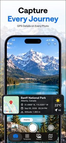
PinCam: GPS Map Photo Tag helps you capture photos with useful location, date, time, address, GPS, and map information displayed directly on each image.
Create organized photo records for construction sites, inspections, property visits, surveys, travel, maintenance work, deliveries, field activities, and everyday documentation.
CAPTURE LOCATION-TAGGED PHOTOS
Add available location and environmental details to your photos, including:
• GPS location
• Latitude and longitude
• Address
• Date and time
• Map details
• Altitude
• Compass direction
• Weather information
• Location accuracy
The displayed information gives helpful context about where and when a photo was captured.
GPS MAP CAMERA FOR FIELDWORK
PinCam helps you create organized visual records for professional and everyday activities, including:
• Construction and building projects
• Site visits and fieldwork
• Property and real estate documentation
• Inspections and surveys
• Engineering and architectural work
• Maintenance and service visits
• Delivery location records
• Project progress documentation
• Business visits
• Travel and outdoor photography
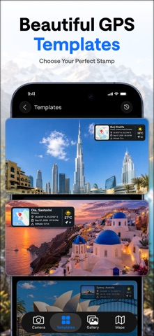
CUSTOMIZE YOUR PHOTO TAG
Choose which information appears on your photos. Create a simple tag with date and location, or add available details such as address, GPS coordinates, map, altitude, compass direction, weather, and location accuracy.
MAP AND LOCATION DETAILS
View captured locations on a map and add useful geographic information to your images. Latitude, longitude, address, and map details can help identify where a photo was taken.
BUILT FOR PROFESSIONAL DOCUMENTATION
Capture site conditions, completed work, property details, maintenance visits, delivery locations, surveys, inspections, and project progress directly from your device.
PinCam can support professionals working in construction, real estate, engineering, architecture, surveying, inspections, delivery services, maintenance, and field operations.
TRAVEL AND OUTDOOR PHOTOS
Save travel memories with location and time information included on your photos. Record road trips, hiking destinations, scenic places, outdoor activities, and memorable locations with useful GPS and map details.
SIMPLE AND PRACTICAL
Capture a photo, choose the information you want to display, and create an informative visual record directly from your device.
P