Field Area Measure: GPS Map

Field Area Measure: GPS Map Summary
Field Area Measure: GPS Map is a free iOS app in Maps And Navigation by RAYO INNOVATIONS PRIVATE LIMITED. Released in Sep 2026 (recently released ago). Store last updated Sep 24, 2026
Field Area Measure: GPS Map SDKs Summary
App not yet scanned for SDKs.
0★
Ratings:
Screenshots

App Description
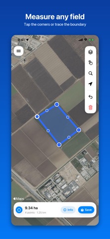
Measure any piece of land straight from the map - no equipment, no walking the boundary. Tap the corners or trace the edge with your finger, and the area updates as you go.
THREE MODES
- Area - a field, plot, roof or lawn
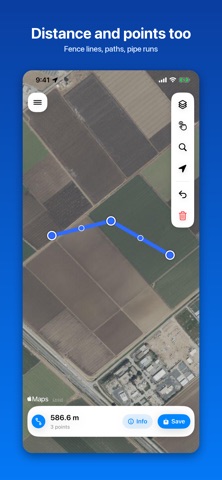
- Distance - a fence line, a path, a run of pipe
- Point - a single marked location
DRAW IT YOUR WAY
Tap corner by corner, trace freehand, or line up the crosshair and add points one at a time. Drag any corner to correct it. Undo anything.
YOUR UNITS
Acres, hectares, square meters, square feet, square yards, square kilometers, square miles. Meters, kilometers, feet, yards, miles, nautical miles. Every result carries a second unit underneath, so a figure reads both ways without switching.
STANDARD, SATELLITE OR HYBRID
Satellite and hybrid imagery show crop boundaries and field edges that the standard map does not.
KEEP AND SHARE
Saved measurements live in a searchable library, each with a thumbnail of its shape. Export to KML, GPX, GeoJSON, CSV or an image. Open KML and GPX files sent from Files, Mail or any other app.
ALSO INCLUDED
A full-screen compass showing your heading and coordinates, ready to copy.
MEASURED PROPERLY
Distances use Vincenty's inverse solution on the WGS-84 ellipsoid; areas use spherical excess. No accounts, no subscriptions, no ads, no third-party code. Your measurements stay on your device.