Taiwan Rail Log

Taiwan Rail Log Summary
Taiwan Rail Log is a free, with in-app purchases iOS app in Travel And Local by SungHyuk Yoon. Released in Sep 2026 (recently released ago). Store last updated Oct 5, 2026
Taiwan Rail Log SDKs Summary
App not yet scanned for SDKs.
0★
Ratings: 0
Screenshots




App Description
Every line you ride fills in with color.
Taiwan Rail Log (鐵道誌) is a ride-logging app for Taiwan's railways: 39 lines and 589 stations across the TRA network, Taiwan High Speed Rail, the Taipei, New Taipei, Taoyuan, Taichung and Kaohsiung metro and light rail systems, and the Alishan Forest Railway.
Tap a station to log it, and watch the rail map become your personal achievement map.
◆ Made for
· Travelers exploring Taiwan by train, from the High Speed Rail to the Pingxi and Jiji branch lines
· Riders working toward every TRA line, or circling the island by rail
· Anyone who wants years of train trips in one place
◆ Log your rides
· Tap stations to check them off, or enter a whole segment at once
· Pick any visit date — backfill trips from years ago
· Attach photos and notes to each station
· Find nearby stations with GPS and log them on the spot
· Transfer stations shared by TRA, High Speed Rail and metro lines are grouped together
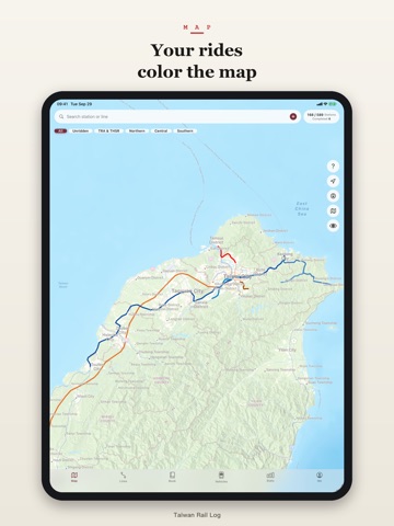
◆ See it on the map
· Ridden lines are painted in their real line colors
· Filter to unridden lines when planning your next trip
· Tap any line for progress and its station list
◆ Collect
· Every visited station becomes a stamp in your stamp book
· Celebration cards appear when you complete a line or reach a station milestone — share them straight to social media
· A rolling stock book of 29 trains, from the THSR 700T and the Puyuma and Taroko expresses to metro trains and Alishan's steam locomotives
◆ Cab View (beta)
Follow the stretches you rode from above, over satellite imagery and 3D buildings. Underground, you fly over the streets above your ride. Export the flight as a video to share.
Satellite and terrain tiles use a lot of data, so Wi-Fi is recommended.
◆ Pro (monthly / yearly / lifetime)
· Unlimited favorite lines
· Detailed statistics and the 22-county heatmap
· Watermark-free share cards
· Export your stamps as an A4 PDF stamp book
· In Cab View: reverse the direction, pick a stretch, and export 60-second or 15-second videos (free: 30 seconds)
Browsing lines, logging rides, the stamp book, and iCloud sync are all free.
Monthly and yearly plans auto-renew through your Apple ID unless cancelled at least 24 hours before the current period ends. Lifetime is a one-time purchase.
◆ Your records stay yours
· iCloud sync carries your log to a new iPhone, free of charge
· Expo