Utility Data Collection

Utility Data Collection Summary
Utility Data Collection is a mobile iOS app in Tools by CORVALLIS MICROTECHNOLOGY, INC.. Released in Oct 2013 (12 years ago). Store last updated Dec 29, 2024
Utility Data Collection SDKs Summary
App not yet scanned for SDKs.
0★
Ratings: 0
Screenshots
App Description
Utility Data Collection is a utility asset management and meter reading app built on top of a powerful GPS/GIS mapping platform. It can help the city or utility company employees efficiently perform a number of different tasks. Use the GPS/GIS data collection functions to record the locations and conditions of existing utility poles, utility meters and other equipments. Use the same functions to map land plots owned by your organization. Attach one or more photos to the surveyed item. Use the import and export function to easily set up meter routes, upload meter database and export meter readings. Use the Meter Reading data input panel to enter the monthly meter readings and any observations or remarks. Use the sample files as templates for customizing your own GPS/GIS utility data collection and meter reading applications.
The powerful GPS GIS mapping and data collection functions can be just as helpful to other professionals in the fields of fish & wildlife, natural resources, land management, oil and gas, archaeology, sales route management, etc.
The intuitive user interface and the detailed built-in help document will enable you to effectively collect GPS/GIS data and increase productivity within a short time.
Please note: Location data depends on the GPS receiver used. Continued use of GPS running in the background can dramatically decrease battery life. This app will let you easily toggle the built-in GPS on or off. This app comes with a built-in help file.
Function Highlights:
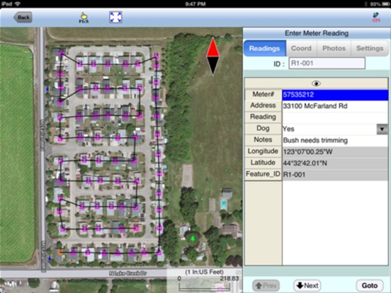
* Enter readings in a dedicated data input screen.
* Optionally display the meter route or data collection route.
* Know at a glance which meters/sites have been recorded.
* Import and export Shapefiles, DXF and text files.
* Record GPS Points, Lines and Areas.
* Precisely digitize Points, Lines and Areas over the built-in Map.
* Move existing nodes to fine-tune the map drawing.
* View position, length and area values for the Features.
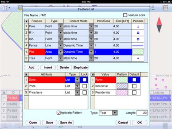
* Create multiple attribute tables (Feature Lists).
* Tag the Features with pre-defined Attribute/Values and symbols.
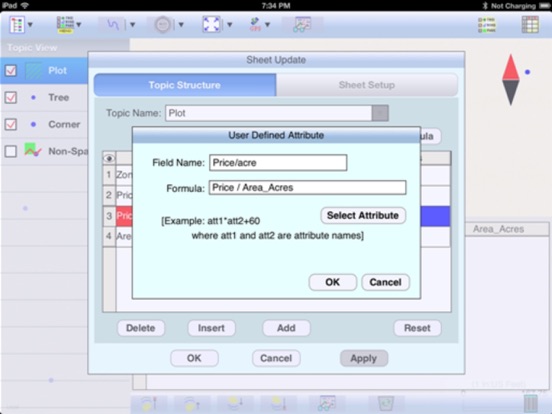
* Enter a formula for an Attribute based on other Attributes.
* View/edit Attribute Values in a full-page spread-sheet.
* Sort the data records based on specified Attribute.
* Search for data record based on Attributes.
* Label the Features with Attributes, area and segment lengths.
* Measure distances and areas without sav