NavLink UK
NavLink UK Summary
NavLink UK is a with in-app purchases iOS app in Maps And Navigation by DigitalYacht Ltd.. Released in Jan 2014 (12 years ago). Store last updated Aug 24, 2023
NavLink UK SDKs Summary
App not yet scanned for SDKs.
0★
Ratings: 0
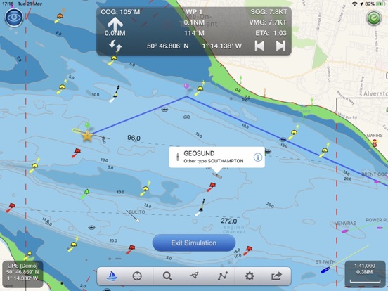
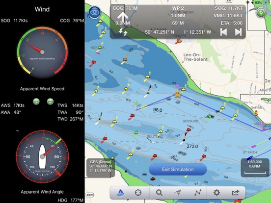
Screenshots
App Description
Marine Navigation App that turns your Apple Device in to a full function chart plotter. Features include;
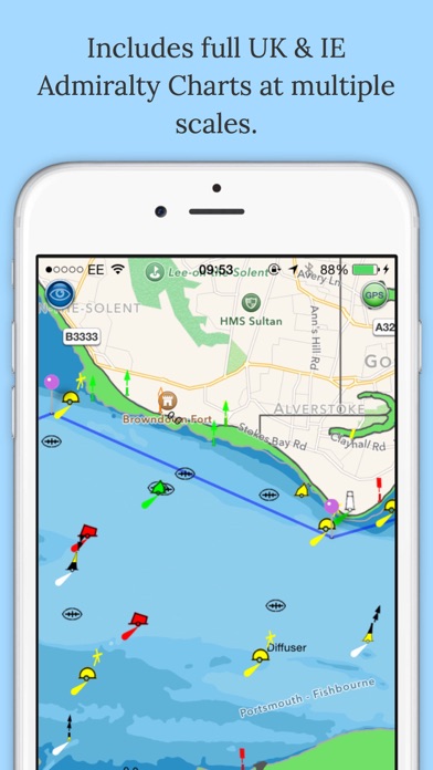
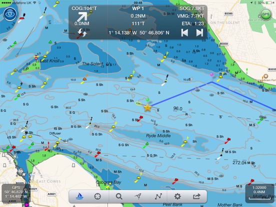
· Realtime GPS position plotted on Marine charts derived from UKHO data
· AIS overlay when connected to compatible wireless AIS system
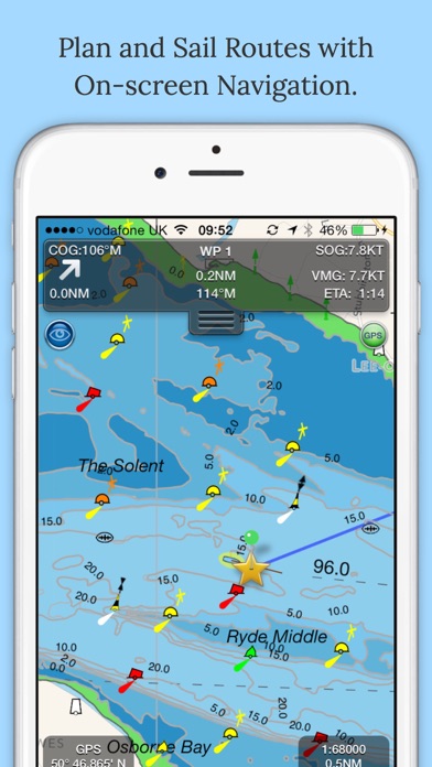
· Waypoints and routes with full route editing and planning function
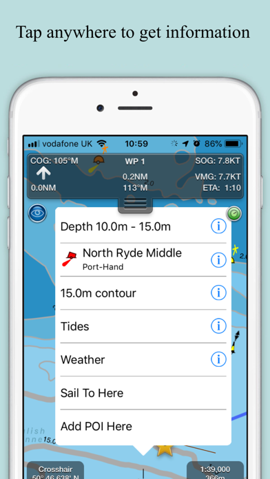
· Position, COG, SOG, VMG, bearing, distance and ETA displays
· Configurable chart layers
· Tidal Streams (UK and IE)
· HorizonView overlays navaid and targets onto iPad/Phone camera display
· Automatic free chart updates included for 1 year
· Weather buoy data
· A-B chart ruler for quick and easy bearing and distance measurement
· All UK & Ireland charts are included in the price
· Optional in-app purchase of French, Benelux, Danish and German charts
AIS Functionality
When connected to an AIS system via a wireless NMEA link, NavLink will provide a real time overlay of AIS targets and CPA and TCPA alarms
HorizonView
Overlay chart and AIS objects on the iPhone or iPad camera image to create an augmented HorizonView display, that makes Nav-Aid and vessel identification simple and reliable
Plan and sail routes
Instant route and waypoint creation by tapping on screen. Route reverse function and route overview with inter-leg bearing and distance. Share your routes via dropbox and email with other users.
Interfacing
NavLink is compatible with all Digital Yacht's wireless NMEA devices such as the iAIS, WLN10, WLN10HS, NavLink, iNavHub and PilotLink that stream wireless AIS data to your Apple device.
If you have a WiFi-only iPad or iPod you will need an external Bluetooth GPS receiver to enable navigation. Inexpensive 3rd Party units are available such as the Garmin Glo.
Please note: Continued use of GPS running in the background can dramatically decrease battery life.
Safety Notice
NavLink (including the charts) is an aid to navigation. Only official government charts and notice to mariners contain all of the current information needed for safe navigation. This product's features cannot be relied on to be complete or accurate and may vary locally. It is the Captain's or Boat Owner's responsibility to use official government charts, notice to mariners, caution, sound judgement and proper navigational skill when operating their