SeaNav
SeaNav Summary
SeaNav is a free, with in-app purchases iOS app in Maps And Navigation by Pocket Mariner Ltd.. Released in Apr 2014 (12 years ago). It has 804 ratings with a 4.42★ (good) average. Based on AppGoblin estimates, it reaches roughly 1.4K monthly active users and generates around $<10K monthly revenue (100% IAP / 0% ads). Store last updated May 18, 2026
SeaNav SDKs Summary
SeaNav was last scanned for SDKs on 2026-06-29. No known SDKs were detected. Check the raw list of SDK parts detected here and feel free to request unknown SDKs be added to AppGoblin.
4.42★
Ratings: 804
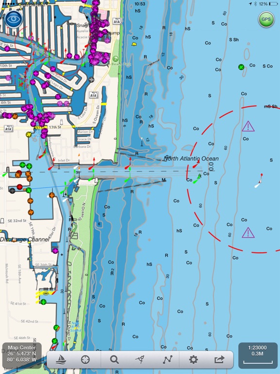
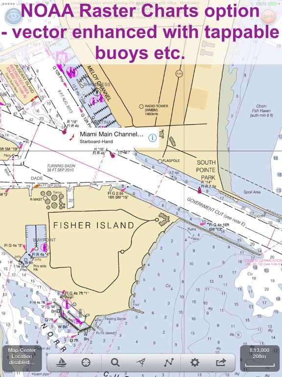
Screenshots
App Description
UI Update for iOS26
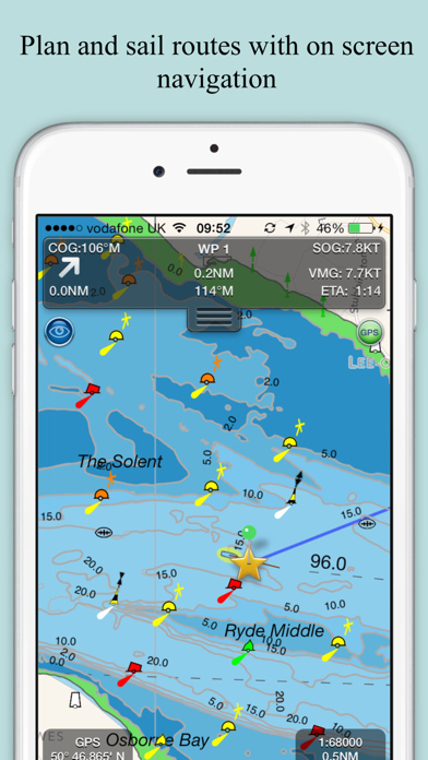
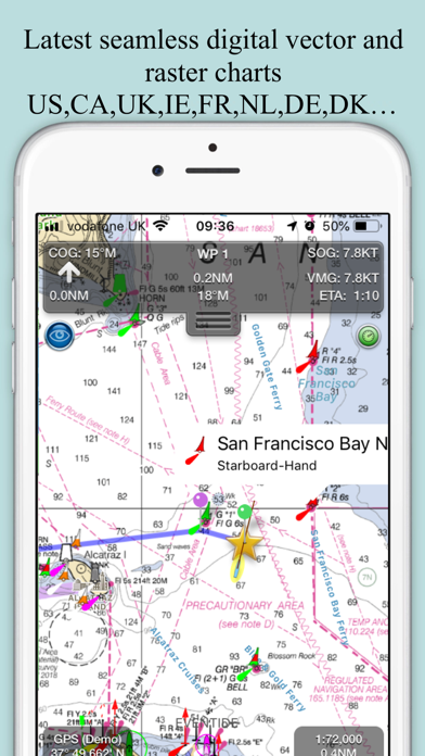
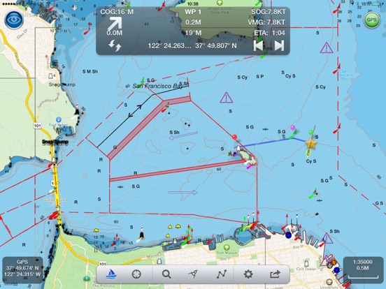
SeaNav combines high-resolution marine charts, route planning and real-time navigation in one simple boating app for your iPhone, iPad and Apple Watch.
Charts, Autoroute planning, AIS ship tracking, tides and weather in one powerful and affordable navigation app.
Built from official hydrographic data with extensive coverage across North America, Europe and Australia.
Professional marine navigation features including:
Planning
• Create and edit routes with auto-routing for creating waypoints
• Measure distance & bearing
• Import & export GPX routes
• Tides, Streams & Weather
• Works offline
Navigate with Confidence
• Real-time GPS navigation
• Course Up & North Up modes
• ETA, XTE, VMG, SOG & COG
• Sailing HUD display
• Background navigation
• Automatic Waypoint advancing & alerts
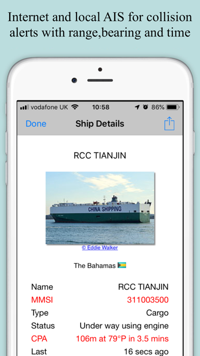
Live AIS & Safety (Optional IAP)
• Real-time AIS ship positions
• Collision alarms
• AIS position sharing
• Internet AIS integration
• Free AIS when used with Boat Beacon
• MOB and Anchor alarm (IAP)
- NMEA Link for Depth, Wind & AutoPilot
- Real time local wind feed and Sailing laylines display (IAP)
Alongside this SeaNav offers advanced onboard capabilities rarely found in a single app:
Apple Watch app
SeaNav for Apple Watch is included at no extra cost, giving you route data, key navigation information and quick access controls directly from your wrist.
Sophisticated AIS Display and Position sharing
The leader in the field with global coverage and clear, information-rich vessel tracking with intelligent filtering and collision prediction tools.
CPA and TCPA alerts help you assess risk early and act confidently.
Augmented Reality View
Overlays navigation, AIS and chart data directly onto the real-world camera view for intuitive situational awareness.
Includes night mode support for compatible thermal cameras such as FLIR.
SeaNav Autoroute and Autopilot Integration
- Just choose where you want to go and SeaNav will create the route for you
- Go one step further and let SeaNav pilot the route with compatible autopilot systems from Raymarine, SIMRAD, Lowrance and B&G
SeaNav comes with a built-in tutorial mode with free access to all features including charts, AIS, AR & wind
The free version includes all navigation and trip planning tools. High resolution vector charts are available by In App Purchase (IAP) inclu