Safety tips
Safety tips Summary
Safety tips is a mobile iOS app in Weather by RC Solution Co.. Released in Jun 2014 (12 years ago). It has 28 ratings with a 2.14★ (poor) average. Based on AppGoblin estimates, it reaches roughly 72 monthly active users . Store metadata: updated May 28, 2026, version 3194.
Data tracking: SDKs and third-party integrations were last analyzed on May 25, 2026.
Store info: Last updated on App Store on May 28, 2026 (version 3194).
SDKs, Trackers & Permissions
Safety tips was last scanned for SDKs 2026-05-25. Below is the overview of third party companies detected in the app. The full list of raw SDKs, app permissions and unknown SDKs is available here.
AppGoblin saw Safety tips uses 1 Development Tools
App Details
App Store
Ads & App-Ads.txt
AppGoblin SDK Scans
2.14★
Ratings: 28
Screenshots
App Description
Note:
Weather warnings and advisories area in Nara City, Nara Prefecture has changed.
Please update to the latest version of Safety tips.
Also, if you have set up Nara City, Nara Prefecture, please reset the location.
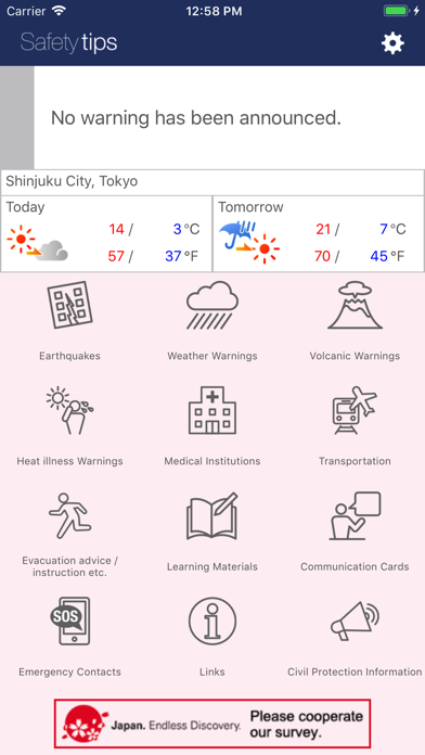
This Application notifies a user with EEW, Tsunami Warnings, Volcanic Warnings, Weather Warnings, Heat illness Warnings and Civil Protection Information issued in Japan. It is a free application developed under the supervision of Japan Tourism Agency.
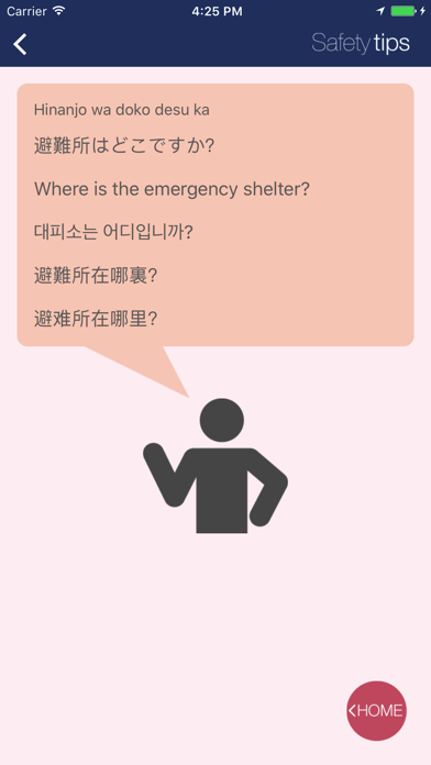
The Application provides various functions useful for foreign tourists in Japan. The application is available in five languages: English, simplified and traditional Chinese, Korean, and Japanese.
<Main functions and its utilization>
-Receiving Earthquake Early Warnings, Tsunami Warnings, Volcanic Warnings, Weather Warnings, Heat illness Warnings and Civil Protection Information.
Before using the Application for the first time, select locations for which you wish to receive warnings from the Settings Menu (you may select a maximum of five locations (in Japan only))(*). Users will receive notifications when Earthquake Early Warning for local earthquakes of seismic intensity level 4 or greater, Tsunami Warning, Volcanic Warnings, Emergency Warnings , Heat illness Warnings, or Civil Protection Information are issued for the selected locations. Also, please make sure that the device which has not been changed a prediction point for more than 1 month from final change date of setting will not be able to receive notifications. If you turn automatic setting of a point on, you can receive notifications even in the case that it has been more than 1 month since you set a prediction point.
(*) It is necessary to activate the Location Information Service (GPS), if you wish to set locations by using GPS. GPS is also used to display your current location on the map.
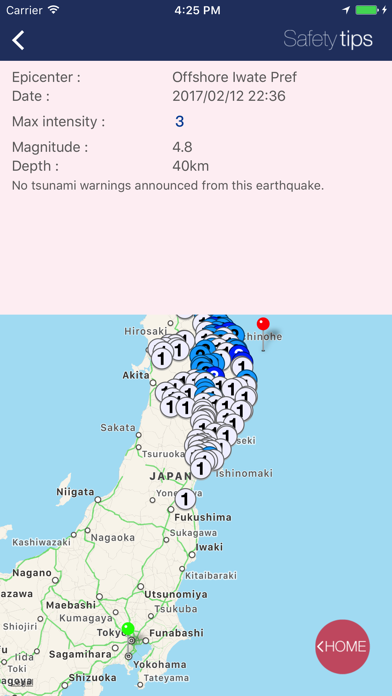
-Earthquakes
Information on past earthquakes. A maximum of ten records (seismic intensity level of 3 or higher.)
-Weather Warnings
Weather Warnings (heavy rain, flood, violent wind, severe snowstorm, heavy snow, high seas, storm surge) and Emergency Warnings (heavy rain, violent wind, severe snowstorm, heavy snow, high seas, storm surge) issued for the selected locations.
-Volcanic Warnings
Currently issued Volcanic Warnings.
-Heat illness Warnings
Currently issued Heat illness Warnings.
-Medical Institutions
List of medical facilities a