Seapilot
Seapilot Summary
Seapilot is a with in-app purchases iOS app in Maps And Navigation by Seapilot. Released in Oct 2014 (11 years ago). It has 20 ratings with a 3.00★ (mixed) average. Based on AppGoblin estimates, it reaches roughly 51 monthly active users and generates around $<10K monthly revenue (100% IAP / 0% ads). Store metadata: updated Jun 14, 2024.
Store info: Last updated on App Store on Jun 14, 2024 .
3★
Ratings: 20
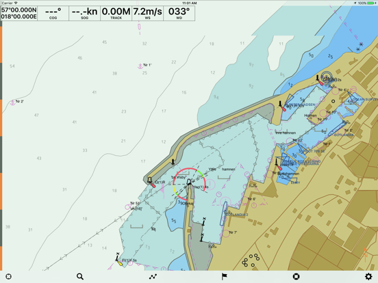
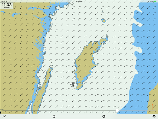
Screenshots


App Description
Professional marine navigation used to require an expensive GPS plotter. Now, same technology used in merchant shipping is available for the iPad and iPhone.
Seapilot lets you navigate like a pro with vectorized S-57 chart data from National Maritime Administrations. This is the first navigation app to feature Automatic Identification System (AIS) and built in weather forecasts, when within a mobile network. Charts and features available as In-App Purchase.
Use it to navigate, to plan tomorrow’s boat trip or reminisce about yesterday’s. (PS. Even works in your sofa at home.)
Seapilot features:
• Free trial period of included functionallity
• Professional navigation based on merchant shipping standards for ECDIS (Electronic Chart Display and Information System)
• S-57 chart data (In-App Purchase) and AIS data from National Maritime Administrations
• Developed by True Heading, leaders in marine navigation and communication at sea, with cutting-edge AIS and VHF know-how
Functions:
Δ Positioning and background positioning via GPS
(Continued use of GPS running in the background can dramatically decrease battery life)
Δ Visualization of S-57 chart data from National Maritime Administrations
Δ Autonomous navigation - charts (In-App-purchase) downloaded to the device
Δ Option of tracking your own boat on the chart
Δ Displays position, course and speed
Δ Adjustable own speed and course vector
Δ Man Overboard function
Δ Display settings for day, dawn/dusk and night
Δ Past track
Δ Plotting/marking objects
Δ Electronic bearing and range marker from own vessel
Δ True Motion and adjustable North Up / Head Up chart orientation
Δ Chart object search
Δ AIS target search
Δ Setting of safety contour (2, 3, 6, 10 and 15 meters)
Δ World chart for rough overview/orientation
Δ Facebook integration; share position with friends or all users, list friends, show friends or all users on chart, post on was
Premium:
Δ Routes
Δ Weather Routing
Δ Weather Forecast, High quality 5-day Coastal Weather Forecasts.
Δ AIS data from National Maritime Administrations via Internet (3G or WLAN)
Δ Course and speed vector for AIS targets
Δ NMEA-0183 interface for connecting external GPS/AIS via WIFI
Δ Import/Export to GPX-file
== Auto-renewable subscriptions in Seapilot ==
• Seapilot Premium, Annual Subscription: $39.99
• Swedish Charts wit