Tracks4Africa Guide
Tracks4Africa Guide Summary
Tracks4Africa Guide is a with in-app purchases iOS app in Books And Reference by Tracks4Africa. Released in Mar 2015 (10 years ago). It has 12 ratings with a 4.08★ (good) average. Based on AppGoblin estimates, it reaches roughly 49 monthly active users and generates around $<10K monthly revenue (100% IAP / 0% ads). Store metadata: updated Jan 19, 2026.
Data tracking: SDKs and third-party integrations were last analyzed on Feb 15, 2025.
Store info: Last updated on App Store on Jan 19, 2026 .
Tracks4Africa Guide was last scanned for SDKs 2025-02-15. Below is the overview of third party companies detected in the app. The full list of raw SDKs, app permissions and unknown SDKs is available here.
4.08★
Ratings: 12
Screenshots


App Description
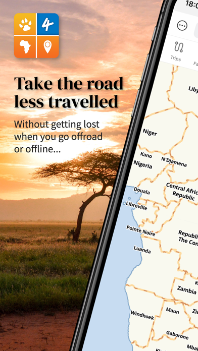
Welcome to the most detailed travel guide for overland travel in Africa. This offline app offers a great map and huge amount of detailed places of interest for planning your next safari. Your GPS location will ensure you stay orientated while using the app on your self-drive trip.
Try it out
The app contains samples of the map and guide information, which can be upgraded to full country maps and guides.
How does it work?
This is not a routing/navigation app. The app aims to bring you offline access (i.e. no internet connection required) to the following:
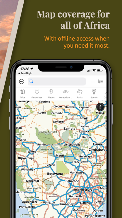
• A detailed map of the country or region you purchase. The country map roughly corresponds to a 1:1 000 000 paper map in terms of its detail and will allow you to view the map at different zoom levels. The map works similar to a web map with the difference being that all information is installed on your device. It contains place names like cities, towns and villages together with a detailed road and track network. It also shows you all protected areas such as national parks and game reserves together with relevant background data such as rivers, mountains and major attractions.
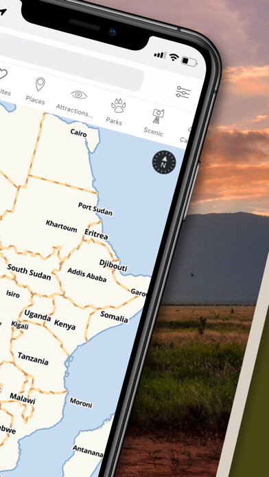
• A detailed guide with the following categories: Places (cities, towns, etc), Attractions & Activities, Parks, Scenic, Camps, Lodging, Food & Drink, Fuel, Shopping, Services and More (miscellaneous points of interest). The guide information is linked to a location on the map and will display as a pin on the map for you to know where it is in reference to where you are.
The app will display a map of the country or region and allow you to switch on different categories of points of interest. You can also search for specific places by name. The map search is location sensitive, i.e. results will be relative to the centre of the map.
Your position, determined from your iPhone or iPad’s location service, will display on the map so you can accurately orientate yourself on the map. As you drive, your location will update on the map so you always know where you are. (iPhone or iPad with GPS required)
The search functionality is linked to the guide categories. For example, if you need to find a campsite, simply switch on the Camps category. Immediately all campsites around you will display on the map and you can click on them for more information. Otherwise, if you know the name of a campsite, enter it into the search block