Airmate
Airmate Summary
Airmate is a with in-app purchases iOS app in Maps And Navigation by Myriel Aviation SA. Released in Jul 2017 (8 years ago). It has 3.8K ratings with a 4.58★ (excellent) average. Based on AppGoblin estimates, it reaches roughly 10K monthly active users and generates around $<10K monthly revenue (100% IAP / 0% ads). Store metadata: updated Jan 7, 2026, version 10126.
Data tracking: SDKs and third-party integrations were last analyzed on May 30, 2026.
Store info: Last updated on App Store on Jan 7, 2026 (version 10126).
SDKs, Trackers & Permissions
Airmate was last scanned for SDKs 2026-05-30. Below is the overview of third party companies detected in the app. The full list of raw SDKs, app permissions and unknown SDKs is available here.
AppGoblin saw Airmate uses 1 Ad Networks
App Details
App Store
Ads & App-Ads.txt
AppGoblin SDK Scans
4.58★
Ratings: 3.8K
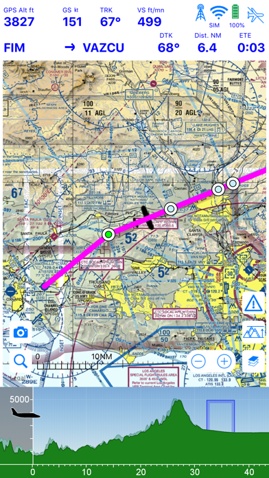
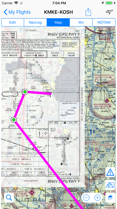
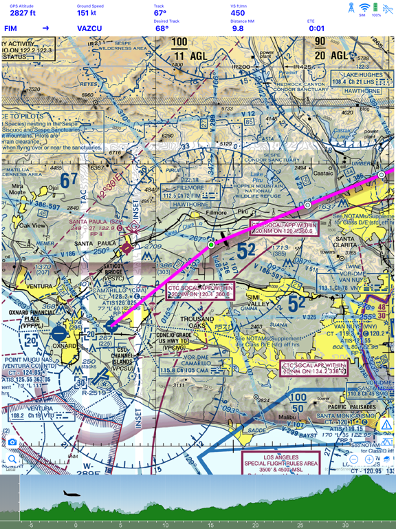
Screenshots


App Description
Airmate is a free and easy to use flight planning and weather app for pilots, improving situational awareness and providing instant access to airport data and aviation maps, up to date weather and NOTAMs, traffic around.
IFR and VFR airport plates are freely available in US (FAA charts), Europe, and more than 200 other countries. Many of them are georeferenced and could be overlaid on the aviation chart. A powerful Plate Manager allows to download in advance all airport plates in a country, they could be easily printed and viewed.
During the flight, the moving map will display the aircraft location along the route, show airports and aeronautical data details and traffic around, warn you if your planned route is crossing restricted areas. A profile view is available to display terrain elevation, crossed areas and forecasted weather across the route. Airmate can also display a backup aircraft attitude indicator and flight parameters in an EFIS-like view. In the whole world, Synthetic Vision displaying in the EFIS-like view the ups and downs of rolling terrain ahead is available. In selected countries, Airmate can display scenery if this option is purchased.
Airmate includes a worldwide aeronautical database updated free of charge with airports, navigation beacons, waypoints, airways, obstacles, regulated and restricted areas. Topographic maps and elevation data for most countries may be downloaded free of charge, as well as additional aviation map overlays such US Sectionals. A procedure database provide details of departure (SID), arrival (STAR) and instrument approaches in the USA, and you could add those procedures to your planned flight route (the procedure database includes all US airports, we are workding to add airports in other countries). Once loaded, the procedure path is displayed on the aeronautical map, including curved paths and racetracks.
When coupled with a supported external ADS-B received, Airmate will display nearby traffic on the moving map, and receive FIS-B weather and NOTAM during the flight. To improve safety, Airmate can display neighbouring traffic received over mobile network. Such traffic include commercial airlines and transponder-equiped aircrafts, FLARM gliders, aircrafts whose pilots are using Airmate and other users using other safety broadcasting equipment.
Airmate is able to transmit the flight plan data to supported av