Farming GPS GIS III

Farming GPS GIS III Summary
Farming GPS GIS III is a mobile iOS app in Maps And Navigation by CORVALLIS MICROTECHNOLOGY, INC.. Released in Jun 2015 (11 years ago). Store last updated Mar 2, 2024
Farming GPS GIS III SDKs Summary
App not yet scanned for SDKs.
0★
Ratings: 0
Screenshots


App Description
“Farming GPS GIS III” provides GPS data collection and mapping functionality for use on the iPad. It will let you use a GPS receiver to map a farm tract, a timber tract or any other land parcel as well as point and line features of interest. You can also create features by importing shapes from Shapefiles or DXF files, by manual digitization or by entering deed calls. The acreage and perimeter of an area feature will be promptly computed. You can easily divide or combine the land plots. You will be able to record attribute information for each geographic feature. You will be able to generate a contour map based on an attribute. You will also be able to enter formulas to compute values derived from the recorded data. For example, when you enter the yield for a farm plot, the yield per acre can be automatically calculated based on the acreage of the plot.
You will be able to export the feature data to Shapefiles, Excel files, DXF files and KML files..
If your device has GPS capability, the Point Stakeout function could help you locate a grid point to dispense fertilizers. The Line Stakeout function could help you lay out a long pipeline.
Please note: The accuracy of the location data depends on the GPS receiver used. Continued use of GPS running in the background can dramatically decrease battery life. The app lets you easily toggle the GPS on or off.
Detailed Function List:
* Import and export from/to Shapefiles, Excel files, DXF files and KML files.
* Export to GPX file.
* Import/Export Point Feature data via text file.
* Load a GeoTiff map image for off-line use.
* Use GPS to map land features as Points, Lines and Areas.
* Precisely digitize Points, Lines and Areas over the built-in Map.
* Draw a deed plot by entering angles and distances.
* Classify the Features on a Topic layer.
* Modify the Line and Area Feature shapes by adding or deleting nodes.
* Transform data to commonly used coordinate systems.
* Move existing nodes to fine-tune the map drawing.
* Tag the Features with pre-defined Attribute/Values.
* View position, length and area values for the Features.
* Sub-divide an Area by Direction Cut, Hinge Cut or a digitized Split-Line.
* Disconnect a Line Feature or an Area Feature.
* Join Features.
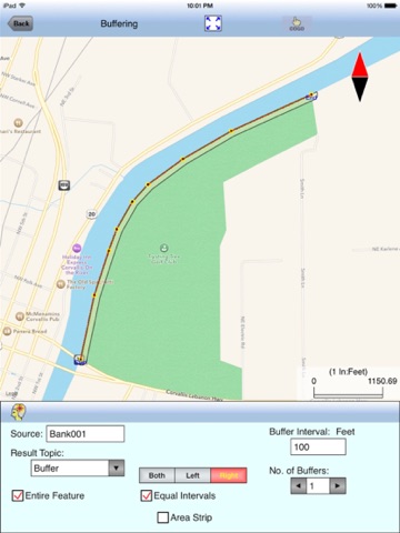
* Create buffer zones around a Line or Area Feature.
* Create grid points or grid lines over an Area Feature.
* Create a contour map