FlightReady E6B

FlightReady E6B Summary
FlightReady E6B is a mobile iOS app in Maps And Navigation by Aeroapps Technology. Released in Oct 2015 (10 years ago). It has 1.1K ratings with a 4.74★ (excellent) average. Based on AppGoblin estimates, it reaches roughly 1.9K monthly active users . Store last updated Sep 25, 2026
Recent activity: 2.00 new ratings this week View trends →
FlightReady E6B SDKs Summary
App not yet scanned for SDKs.
4.74★
Ratings: 1.1K
Screenshots



App Description
FlightReady E6B is a modern flight computer with the most complete set of aviation functions, conversions, and utilities for planning and flying.
WHY PILOTS USE FLIGHTREADY E6B
• Accurate. Conversions use exact defined factors, and airspeed and altitude calculations use the full U.S. Standard Atmosphere, maintaining accurate calculations above 36,000 feet.
• Explained. Every function and conversion has built-in help that describes what it calculates, how to use it, and the formulas and conventions behind it.
• Fast. Star the functions you use most to keep them at the top of the main menu, and your favorites sync to your other devices through iCloud. Open functions from Search, Shortcuts, Control Center, the Lock Screen, or the Action button.
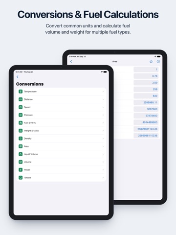
• Easy to use. Change a field's unit from the menu beside it, and every related field on the screen follows. Results automatically carry over to related functions, reducing repeated data entry.
• Night-flight friendly. Dark mode uses a red-shifted amber color scheme designed for use in a dark cockpit.
PLAN LEG
▸ Heading & Groundspeed: true heading, groundspeed, and magnetic and compass heading
▸ Time & Distance: leg time, distance, or groundspeed
▸ Required True Airspeed: the true airspeed and heading needed to make a planned groundspeed
▸ Fuel Consumption: fuel required, fuel flow, or endurance
▸ Point of No Return and Equal Time Point, with ETAs
AIRSPEED, ALTITUDE, AND WEATHER
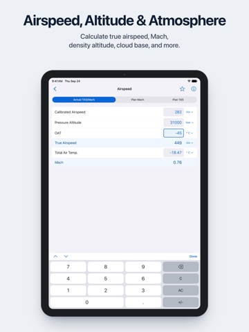
▸ Airspeed: actual TAS and Mach, plan Mach, plan TAS, and total air temperature
▸ Altitude: pressure, density, and true altitude
▸ Cloud Base: cloud base AGL and MSL, and relative humidity, from temperature and dew point
WIND
▸ Wind Component: headwind and crosswind
▸ Unknown Wind
▸ Wind Correction Angle
CLIMB & DESCENT
▸ Climb/Descent Rate: required gradient in ft/nm, percent, and degrees, and rate in ft/min
▸ Top of Descent: determine when to begin descent
▸ Gradient Conversion: percent, degrees, and ft/nm
PERFORMANCE
▸ Rate of Turn and Turn Radius for any bank angle and airspeed
▸ Standard Rate Bank Angle and Standard Rate Turn Radius
▸ Hydroplane Speed for rotating and non-rotating tires
▸ Load Factor in Level Turn
▸ Pivotal Altitude, AGL and MSL
NAVIGATION
▸ DME Arc Distance
▸ Lead Turn Distance: how far before a fix to start the turn
▸ Thunderstorm Cell Height from radar tilt and