Swiss Maps
Swiss Maps Summary
Swiss Maps is a ad-supported, with in-app purchases Android app in Maps And Navigation by ATLOGIS Geoinformatics GmbH & Co. KG. Released in May 2024 (1 year ago). It has about 27.8K+ installs Based on AppGoblin estimates, it reaches roughly 1.8K monthly active users and generates around $<10K monthly revenue (62% IAP / 38% ads). Store metadata: updated Feb 19, 2026, version 405.
Recent activity: 139 installs this week (2K over 4 weeks) showing exceptional growth View trends →
Data tracking: SDKs and third-party integrations were last analyzed on Mar 14, 2026. The app's network data flows (API traffic to/from the app and its SDKs) were last crawled on Oct 1, 2025.
Store info: Last updated on Google Play on Feb 19, 2026 (version 405).
Swiss Maps was last scanned for SDKs 2026-03-14. Below is the overview of third party companies detected in the app. The full list of raw SDKs, app permissions and unknown SDKs is available here.
0★
Ratings: 0
Screenshots


App Description
Easy-to-use GPS navigation app with maps and aerial images for Switzerland.
New App. Introductory price - only for a short time.
Easy-to-use outdoor GPS navigation app with the best topographical maps and aerial images for Switzerland.
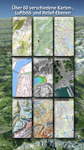
Over 60 different map types for Switzerland. Plus 13 map layers with worldwide coverage and numerous overlays such as hiking or cycling trails.
In addition to the worldwide OpenStreetMap (OSM) maps in various styles, you have access to the detailed official swisstopo maps from the Federal Office of Topography of Switzerland.
There are hiking maps, cycling maps, aerial imagery, geological maps, digital terrain models, aeronautical maps and historical maps for the whole of Switzerland.
There are also numerous switchable overlays such as hiking and cycling trails, river network, contour lines and shading.
Maps and aerial photographs can be downloaded free of charge for defined regions so that you do not need an Internet connection when travelling.
There are also map layers from other commercial map providers such as Google, ESRI or Bing (these are only available online).
All maps can be added as an overlay and compared using a transparency slider.
There is no such thing as the perfect map - so you can use this app to decide which map is best suited to your purpose and region.
The most important functions for outdoor navigation:
- Creating and editing waypoints
- GoTo waypoint navigation
- Measuring routes and areas
- Tripmaster with data fields for daily kilometres, average speed, bearing, altitude, etc.
- Search (place names, streets)
- Definable data fields in map view (e.g. arrow, distance, compass, ...)
- Sharing of waypoints, tracks or routes (via eMail, Whatsapp, Dropbox, Facebook, ...)
- Use of coordinates in WGS84, UTM or MGRS
- Record & share tracks with statistics & elevation profile
- Display of altitude and distance by long click on map
- ...
Additional Pro functions:
- Offline use without data connection
- Easy download of map data for OFFLINE use (except Google & Bing)
- Create and edit routes
- Route navigation (point-to-point navigation)
- GPX/KML/KMZ import/export
- Unlimited waypoints & tracks
- Add new Tile Servers, WMS map services, MBTiles
- No advertising
Map layer for Switzerland:
- Topographic national maps (1:10,000 - 1:1,000,000)
- Swiss TLM
- National Map Winter
- SwissImage Aerial image
- SwissALTI3D terrain model
- Surface model swissSURFACE3D
- Aeronautical chart ICAO
- Glider map
- Geological map 1:25,000 & 1:500,000
- Historical maps
Switchable overlays Switzerland:
- Hiking trails
- Wanderland/Veloland/Mountainbikeland/Skatingland
- Ski routes & snowshoeing
- Water network
- Infrastructure
- Protected areas
- CadastralWebMap
Map layer world:
- OpenStreetMaps : These collaboratively created maps are a very good supplement to the official maps and in some cases also more detailed
- OSM Outdoors: OpenStreetMap data focussing on hiking trails, shading and contour lines
- OpenCycleMaps: OpenStreetMap data with a focus on cycle paths
- ESRI Topographic, Aerial & Street
- Google Road, Satellite & Terrain Map (only with online connection)
- Bing Road & Satellite Map (only with online connection)
- Various overlays such as cycling and hiking trails, shading or bodies of water
Please send questions and feature requests to support@atlogis.com