GPS Map Camera - CampusTag+
GPS Map Camera - CampusTag+ Summary
GPS Map Camera - CampusTag+ is a ad-supported, with in-app purchases Android app in Maps And Navigation by BitSky. Released in Mar 2025 (1 year ago). It has about 44+ installs Based on AppGoblin estimates, it reaches roughly 3.00 monthly active users and generates around $<10K monthly revenue (55% IAP / 45% ads). Store metadata: updated Jul 22, 2025.
Store info: Last updated on Google Play on Jul 22, 2025 .
0★
Ratings: 0
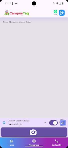
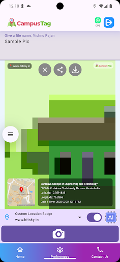
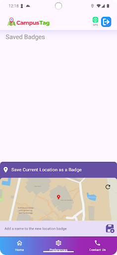
Screenshots

App Description
Effortlessly custom geotag your photos with our AI Powered GPS Map Camera
📌 Why Choose CampusTag+ - The GPS Map Camera?
✅ Accurate Geo-Tagging – Automatically tag your photos with precise GPS coordinates, ensuring reliable location-based documentation.
📍 Custom Location Badges – Create and tag specific locations, whether it’s your office, school, event venue, or any place not listed on standard maps.
🧠 AI-Powered Smart Tagging – Let the app’s AI automatically detect and tag the nearest custom badge location, making documentation effortless.
🚀 How It Works:
📸 1. Capture – Take photos within the app, and it embeds exact geolocation details instantly.
🗺️ 2. Customize – Define your own custom locations for precise tagging beyond standard map coverage.
📤 3. Download & Share – Manage and share geotagged photos with just a tap!
🎯 Who Can Use It?
Travelers & Bloggers – Document trips with precise location stamps.
Photographers – Organize photos with automatic location tagging.
Businesses & Organizations – Maintain accurate location-based records.
Event Managers – Track and tag event locations seamlessly.
Students & Researchers – Store location-based data for projects and reports.
📥 Download Now & Experience Effortless Geo-Tagging Anywhere!