Map Over Pro - Custom Overlays
Map Over Pro - Custom Overlays Summary
Map Over Pro - Custom Overlays is a ad-supported Android app in Maps And Navigation by Core Software Design LLC. Released in Jun 2018 (7 years ago). It has about 150.5K+ installs and 362 ratings with a 4.48★ (good) average. Based on AppGoblin estimates, it reaches roughly 9.8K monthly active users and generates around $<10K monthly revenue (0% IAP / 100% ads). Store metadata: updated Jun 15, 2025.
Recent activity: 1.1K installs this week (8.9K over 4 weeks) showing steady growth , and 3.00 new ratings this week View trends →
Data tracking: SDKs and third-party integrations were last analyzed on Feb 6, 2026. The app's network data flows (API traffic to/from the app and its SDKs) were last crawled on Nov 16, 2025.
Store info: Last updated on Google Play on Jun 15, 2025 .
Map Over Pro - Custom Overlays was last scanned for SDKs 2026-02-06. Below is the overview of third party companies detected in the app. The full list of raw SDKs, app permissions and unknown SDKs is available here.
4.48★
Ratings: 362
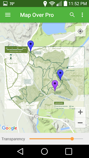
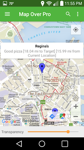
Screenshots


App Description
Use GPS navigation with your own maps, land surveys, PDFs, and more.
Navigate using your own maps, land surveys, or images. Track your current location, mark waypoints to pinpoint spots, and calculate distances. Use the built-in compass to navigate directly to any waypoint.
Creating an overlay is simple: select two points on your image and match them to corresponding points on the map.
Use Cases:
- Land Management: Overlay property maps or land surveys, mark boundaries, and measure distances.
- Outdoor Recreation: Add trail maps for hiking, mountain biking, trail running, or cross-country skiing. Use GPS to track your position and display distance to your destination.
- Exploring: Load a zoo or amusement park map to see where you are. Get distance and direction to attractions, restrooms, or food stands.
- Sports & Fishing: Upload golf course maps and track your location. See distances to the next hole or clubhouse. Overlay fishing depth charts and mark your favorite spots.
- Architecture & Real Estate: Import site maps or plot plans to visualize boundaries overlaid on satellite imagery. Measure distances between landmarks.
Map Over Pro is also great for geocaching. Import geocache lists from major geocaching websites. Overlay trail maps, find the best path to the next cache, and drop custom waypoints—like multistage cache clues or your parking spot.
Key Features:
- Use any image or PDF page as an overlay.
- GPS support to show your current location.
- Create or import waypoints.
- Measure distances to any waypoint.
- Unlimited overlays and waypoints.
- Navigate using the built-in compass.
- Adjust map/image transparency.
- Load overlays from internal storage, SD cards, or Google Drive.
- Capture and overlay new images from your camera.
- Choose from Road, Satellite, Terrain, or hybrid base map views.
- Share overlays and waypoints via email or cloud storage.
- Backup and restore data.
- In-app help included.
Why Choose Map Over Pro?
- Ever juggled a printed map in one hand and your phone’s GPS app in the other?
- Ever wished you could overlay a map onto your phone’s GPS so it auto-aligns, rotates, and scales?
- Want the distance and direction to any point just by tapping a location?
Then Map Over Pro is for you!