GPS Map Camera – Geotag Photo
GPS Map Camera – Geotag Photo Summary
GPS Map Camera – Geotag Photo is a mobile Android app in Photo And Video by Dark Cube. Released in Feb 2025 (1 year ago). It has about 1.4K+ installs Based on AppGoblin estimates, it reaches roughly 37 monthly active users . Store last updated Dec 26, 2025
Recent activity: 13 installs this week (67 over 4 weeks) showing steady growth View trends →
GPS Map Camera – Geotag Photo SDKs Summary
App not yet scanned for SDKs.
0★
Ratings: 0
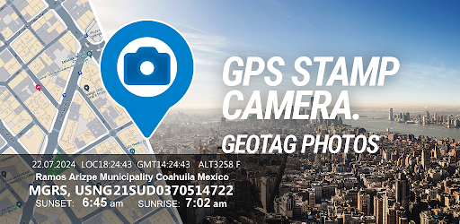
Screenshots


App Description
Enhance your photos with GPS Camera. Capture Moments with Location & Timestamp
Easily Geotag & Timestamp photos with precise GPS location and customizable timestamps using GeoTag GPS Camera. Perfect for travelers, surveyors, outdoor enthusiasts, or anyone who wants to record where and when their photos were taken.
- Geotag photos with accurate GPS coordinates
- Add customizable date and time stamps
- View photo locations on an interactive map
- Adjust location stamp formats and styles
- Save and share geotagged images easily
- Offline mode for remote adventures
- Simple, user-friendly interface
Why Choose GeoTag GPS Camera?
Whether you're documenting a hike, mapping a project, or capturing travel memories, our GPS camera ensures every photo tells a story with location data. The intuitive design makes geotagging effortless, and robust features support professionals and casual users alike.
Download GPS Map Camera now to start capturing your world with GPS precision!