कोल्हापूर नकाशे (Kolhapur maps
कोल्हापूर नकाशे (Kolhapur maps Summary
कोल्हापूर नकाशे (Kolhapur maps is a mobile Android app in Education by Dr. Suresh V. Ranade. Released in Aug 2019 (6 years ago). It has about 4.2K+ installs and 9.00 ratings . Based on AppGoblin estimates, it reaches roughly 67 monthly active users . Store metadata: updated Aug 30, 2024.
Recent activity: 5.00 installs this week (23 over 4 weeks) showing steady growth View trends →
Store info: Last updated on Google Play on Aug 30, 2024 .
0★
Ratings: 9.00
Screenshots


App Description
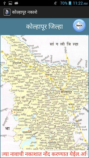
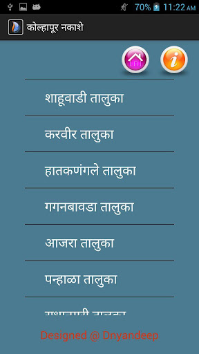
'कोल्हापूर नकाशे' ( Kolhapur District And Taluka maps )
Dnyandeep Infotech Pvt. Ltd. launches another Android App.This app contains Kolhapur district and all taluka's maps which give location area of each taluka and gaon.
Dnyandeep Education & Research Foundation, Sangli (India) is a Public Charitable Trust registered under Public Trust Act(1950) vide No. E/1530/Sangli dated 16-3-2005.
This foundation was established for undertaking Research & Development projects in Information Technology for speedy transfer knowledge about advances in science and Technology and to promote their implementation for the overall development of India. It conducts seminars, exhibitions and training programs for achieving mass literacy, science awareness and human resource development.