GPS Navigation: Live Maps View
GPS Navigation: Live Maps View Summary
GPS Navigation: Live Maps View is a ad-supported, with in-app purchases Android app in Maps And Navigation by Cloud Park. Released in Oct 2017 (8 years ago). It has about 14.2M+ installs and 12.6K ratings with a 4.05★ (good) average. Based on AppGoblin estimates, it reaches roughly 593.5K monthly active users and generates around $50K+ monthly revenue (46% IAP / 54% ads). Store metadata: updated Jan 27, 2026, version 133.
Recent activity: 22.6K installs this week (206.6K over 4 weeks) showing steady growth , and 10 new ratings this week View trends →
Data tracking: SDKs and third-party integrations were last analyzed on May 7, 2026.
Store info: Last updated on Google Play on Jan 27, 2026 (version 133).
GPS Navigation: Live Maps View was last scanned for SDKs 2026-05-07. Below is the overview of third party companies detected in the app. The full list of raw SDKs, app permissions and unknown SDKs is available here.
4.05★
Ratings: 12.6K
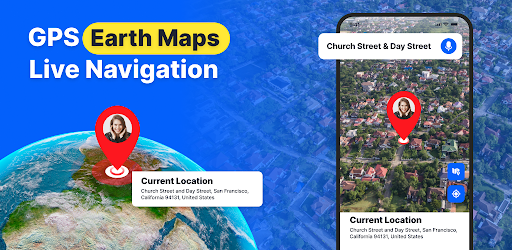
Screenshots


App Description
GPS navigation with nearby places, voice navigation, digital compass, weather
Navigate with confidence using GPS Live Earth Navigation, the all-in-one GPS and map app for driving, exploring, and discovering the world. Whether you’re planning a cross-country road trip, commuting in heavy traffic, or searching for the perfect parking spot, this GPS satellite map provides precise routing, voice navigation, and powerful tools to make every trip effortless and enjoyable.
Key Features & Benefits
- Precision Live GPS Navigation & Nearby Places
- Real-time GPS navigation with turn-by-turn directions for driving, walking, cycling, or off-road adventures.
- Voice-guided directions and alerts to keep your eyes safely on the road.
- Instantly locate your position with the Live Location Finder (latitude & longitude + address) for easy sharing.
- Discover nearby restaurants, landmarks, shops, and attractions—perfect for city travel, daily errands, or road trips.
Customizable Map Styles & Views
Multiple map styles: Default, Satellite, Light Mode, Dark Mode, Terrain, Traffic.
Switch map modes: Normal, Satellite View, Terrain, or Traffic to suit your travel or exploration needs.
Advanced Navigation Tools
- Currency converter for travellers.
- QR Code Scanner for quick scanning & sharing.
- Digital speedometer & compass for orientation and safety.
- Parking Finder & Weather Updates for stress-free navigation.
- Live Traffic Map & Satellite Map layers to avoid traffic jams and plan efficient routes.
- Trip Planner to chart routes, estimate travel times, and organize journeys.
- Altitude & Area Measurement for hiking, exploration, or property mapping.
- World Clock & Country Information help to check times and country details(Calling Code, Language, Currency) while travelling.
GPS Map Camera for Memories
- Capture photos with GPS overlay, including coordinates, address, date/time, and map style.
- Use flash, timer, and custom map styles (Normal / Satellite Map/ Terrain / Hybrid) for memorable travel pictures.
Privacy, Permissions & Ease of Use
GPS Earth Map Radar Navigation only requests essential permissions for accurate GPS navigation, map display, and location services. Your privacy is respected, and the app is designed to work smoothly without unnecessary data access.
Feedback & Support
We value your feedback! Share suggestions or report issues to help us improve GPS Earth Map Radar Navigation. Contact our support team at support@cloudparkstudio.com