Live Satellite Earth Map View
Live Satellite Earth Map View Summary
Live Satellite Earth Map View is a ad-supported Android app in Maps And Navigation by Sky Labs Studio. Released in Jan 2023 (3 years ago). It has about 3.3M+ installs and 3.6K ratings with a 3.67★ (average) average. Based on AppGoblin estimates, it reaches roughly 301.7K monthly active users and generates around $10K+ monthly revenue (0% IAP / 100% ads). Store metadata: updated Mar 13, 2026, version 50.
Recent activity: 74.4K installs this week (208.3K over 4 weeks) showing above average growth , and 52 new ratings this week View trends →
Data tracking: SDKs and third-party integrations were last analyzed on Feb 27, 2026. The app's network data flows (API traffic to/from the app and its SDKs) were last crawled on Oct 17, 2025.
Store info: Last updated on Google Play on Mar 13, 2026 (version 50).
Live Satellite Earth Map View was last scanned for SDKs 2026-02-27. Below is the overview of third party companies detected in the app. The full list of raw SDKs, app permissions and unknown SDKs is available here.
3.67★
Ratings: 3.6K
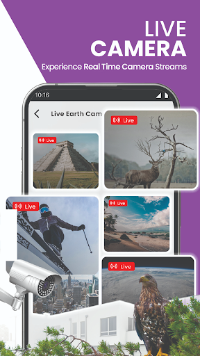
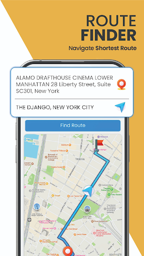
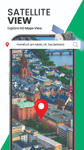
Screenshots

App Description
Live earth map navigation with 3D satellite view, current location & live earth.
Satellite View in 3D with GPS Satellite Map Live Earth View
Experience advanced navigation and global exploration with GPS Satellite Map Live Earth View. This modern navigation app offers immersive 3D satellite maps, live earth map HD, 360 satellite exploration, and smart GPS route navigation tools. Designed to deliver realistic and detailed visuals, the app helps users explore the world using high-resolution satellite imagery and interactive earth maps. With live satellite view technology, users can experience real-world locations with clarity and precision.
Smart GPS Navigation and Route Planning
Navigate efficiently using built-in GPS navigation tools that provide turn-by-turn directions, accurate route planning, and hands-free voice navigation. The smart route planner helps users choose efficient paths for daily travel or long journeys. With real-time map guidance and detailed road views, this GPS navigation app ensures smooth driving and better route understanding through satellite and street-level maps.
Live Satellite View and Global Earth Maps
GPS Satellite Map Live Earth View provides updated satellite imagery that allows users to explore cities, landscapes, oceans, and famous landmarks worldwide. The live earth map HD and 3D satellite view offer realistic visuals of terrain, roads, and urban structures. Whether you are viewing popular destinations or remote areas, the satellite map delivers an enhanced world exploration experience with detailed and dynamic visuals.
Traffic Map, Road Updates, and Navigation Tools
Avoid delays with real-time traffic maps and updated road information. The GPS traffic map helps users stay informed about road conditions and traffic flow while navigating. Integrated tools such as a speedometer showing current, maximum, and average speed, along with a built-in compass, enhance driving awareness and direction accuracy during navigation.
Live Location, Street View, and Direction Support
The app displays your current GPS location accurately on the map and allows you to explore nearby areas using street-level satellite view. Street view maps provide a closer look at roads, buildings, and city layouts, helping users understand their surroundings in real time. Switch easily between satellite view and street map mode for a more detailed navigation experience.
Key Features
- 360 satellite coverage for worldwide exploration
- High-resolution 3D satellite view with realistic visuals
- Live earth map HD with updated terrain and city details
- Turn-by-turn GPS navigation with optional voice guidance
- Street-level satellite and street view maps
- Real-time traffic maps and road condition updates
- Speedometer with speed tracking features
- Built-in compass for accurate direction finding
- GPS satellite maps with interactive zoom and layers
- Area measurement tool for land and distance calculation
Discover the world with powerful navigation and satellite mapping tools using GPS Satellite Map Live Earth View. Enjoy realistic earth maps, smart GPS navigation, street view exploration, and real-time traffic updates—all in one advanced satellite map app.