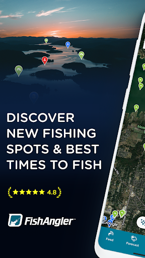
FishAngler: Fishing Guide App
FishAngler: Fishing Guide App Summary
FishAngler: Fishing Guide App is a ad-supported, with in-app purchases Android app in Sports by FishAngler, LLC. Released in Jul 2016 (9 years ago). It has about 1.9M+ installs and 15.2K ratings with a 4.33★ (good) average. Based on AppGoblin estimates, it reaches roughly 70.9K monthly active users and generates around $<10K monthly revenue (36% IAP / 64% ads). Store metadata: updated May 13, 2026, version 250.
Recent activity: 4.3K installs this week (16.4K over 4 weeks) showing steady growth , and 21 new ratings this week View trends →
Data tracking: SDKs and third-party integrations were last analyzed on Jun 2, 2026.
Store info: Last updated on Google Play on May 13, 2026 (version 250).
SDKs, Trackers & Permissions
FishAngler: Fishing Guide App was last scanned for SDKs 2026-06-02. Below is the overview of third party companies detected in the app. The full list of raw SDKs, app permissions and unknown SDKs is available here.
AppGoblin saw FishAngler: Fishing Guide App uses 1 Business Tools
AppGoblin saw FishAngler: Fishing Guide App uses 1 Ad Networks
AppGoblin saw FishAngler: Fishing Guide App uses 5 Development Tools
AppGoblin saw FishAngler: Fishing Guide App uses 4 Analytics: Product
AppGoblin saw FishAngler: Fishing Guide App uses 1 Mediation
App Details
App Store
Ads & App-Ads.txt
AppGoblin SDK Scans
4.33★
Ratings: 15.2K
Screenshots


App Description
Fishing app with maps, forecasts & AI fish ID. Trusted by millions of anglers.
Stop wasting trips. Start fishing smarter.
FishAngler is the AI-powered fishing app trusted by millions of
anglers worldwide. Find verified fishing spots, plan smarter
trips with real-time fishing forecasts, log every catch, and
connect with anglers who know your exact waters.
FIND YOUR SPOT — FRESHWATER & SALTWATER FISHING MAPS
Whether you're planning a bass fishing trip on a local lake,
scouting a river for trout, or heading offshore for saltwater
fishing — FishAngler's fishing map covers it all.
• Millions of verified fishing spots logged by real anglers
• Lakes, rivers, reservoirs, inshore bays, and offshore waters
— US and beyond
• Access points, boat ramps, buoys, depth gauges, and
underwater structure
• Property boundary data — know where you can legally fish
• Advanced GPS: copy/paste coordinates, live compass with
speed and heading
FISHING FORECAST — KNOW BEFORE YOU GO
FishAngler's fishing forecast puts everything you need to plan
in one place.
• 7-day fishing weather with hourly wind, temperature, and
barometric pressure
• Real-time tidal charts for coastal and saltwater fishing
• Moon phase and solunar bite windows — know when fish are
most active
• Animated map layers: radar, wind, current, and cloud cover
CATCH LOG & FISHING TRACKER
Log every catch with 45+ attributes — species, bait, lure,
water temperature, fishing weather, time of day, moon phase,
GPS location, and more.
• Every log entry deepens your fishing intelligence
• Track PBs, species count, and fishing streaks
• Review your catch history to surface what's working on
your local waters
• All catch and location data is private — you choose
what to share
AI FISH IDENTIFICATION — 866+ SPECIES INSTANTLY
Not sure what you caught? FishAngler's AI fish ID tool
recognizes 866+ freshwater and saltwater species in seconds
— powered by Fishial.AI. The most capable fish finder in
your pocket.
FISHING COMMUNITY — ANGLERS WHO KNOW YOUR WATER
FishAngler is where fishing communities live. Get fishing tips
from anglers on your waters, not strangers in another state.
• Local catch reports and real-time fishing activity on your
specific waters
• Angler groups by region, species, and water body
• Catch feed with bait, conditions, and location context from
verified catches
• Share catches, stories, and trip insights with your
fishing community
UPGRADE TO VIP — FISH ON ANOTHER LEVEL
Anglers who upgrade to VIP report better trips, more consistent
catches, and fewer wasted outings.
14-DAY FORECAST + ANIMATED WEATHER LAYERS
Extended fishing weather with animated radar, wind, currents,
and tidal overlays — see conditions in motion. Updated live on
your fishing map.
FISHFORECAST™ — ADVANCED SOLUNAR BITE WINDOWS
Know exactly when fish will feed — down to the hour. Enhanced
solunar predictions powered by advanced AI. Stop fishing the
wrong hours.
BAIT & LURE INTELLIGENCE
Species-specific bait and lure recommendations based on season,
conditions, and real catch reports from local anglers.
VERIFIED EXACT CATCH LOCATIONS
See precise GPS coordinates of recent confirmed catches — logged
by real anglers, verified by catch data.
PREMIUM 3D LAKE & OCEAN MAPS
3D lake contours, ocean floor mapping, shaded relief, and
Garmin Navionics bathymetric charts — explore structure and
depth at every spot.
PRIVATE WAYPOINTS & MAPMODES™
Mark secret spots privately. Save preferred layers, tools, and
species filters for instant one-tap access on the water.
MEMBER PERKS & AD-FREE
Exclusive discounts with participating brands, outfitters, and
fishing experiences. Plus: an ad-free experience from day one.
RATED #1 FISHING APP
Trusted by millions of anglers from bass fishing reservoirs to
offshore saltwater grounds.
Bad trips happen when you go in blind. Great trips happen when you have a guide.
Download free. Log your first catch. Go VIP when you're ready.
Questions? Email: support@fishangler.com