OpenSky - App for Drone Flyers
OpenSky - App for Drone Flyers Summary
OpenSky - App for Drone Flyers is a mobile Android app in Tools by Wing Aviation LLC. Released in Jul 2019 (6 years ago). It has about 596.4K+ installs and 2.8K ratings with a 4.53★ (excellent) average. Based on AppGoblin estimates, it reaches roughly 9.4K monthly active users . Store metadata: updated Nov 7, 2025.
Recent activity: 514 installs this week (2.2K over 4 weeks) showing steady growth , and 4.00 new ratings this week View trends →
Store info: Last updated on Google Play on Nov 7, 2025 .
4.53★
Ratings: 2.8K
Screenshots


App Description
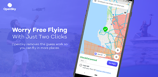
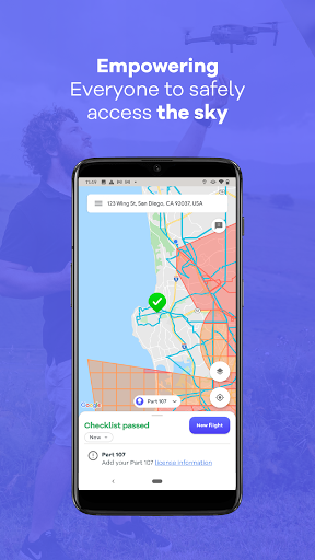
Approved app for Drone Flyers with maps, airspace rules and LAANC authorizations
It’s often difficult for drone operators to determine where they can and cannot fly. OpenSky is the simplest and fastest way to view drone rules and regulations in the U.S. and Australia. Pilots can find out where to fly their drone, plan a flight with a few quick clicks, check airspace rules and get near real-time access to controlled airspace through LAANC.
Features of OpenSky include:
Guide for drone flying - Find out where and when you can and cannot fly based on published aviation regulations set by the FAA (U.S) and CASA (Australia).
Compliance maps from Aviation Authorities - OpenSky makes it easy to visualize airspace rules tailored to your operation and aircraft; for both recreational & commercial drone operators.
Identify Risks - OpenSky will help identify possible flight hazards in your area like Temporary Flight Restrictions (TFRs).
Airspace authorizations - Drone operators can automatically request authorization to fly in controlled airspace, including the busy airspace near major cities. In the United States this is called LAANC.
Track your missions - OpenSky will track and manage your past and upcoming flights, and notify you of changes to any planned flights.
You can find out more about Opensky at: www.wing.com/opensky