GeoTag Camera: GPS Photo Stamp
GeoTag Camera: GPS Photo Stamp Summary
GeoTag Camera: GPS Photo Stamp is a ad-supported Android app in Photo And Video by TSoft Productions. Released in May 2025 (11 months ago). It has about 2K+ installs Based on AppGoblin estimates, it reaches roughly 26 monthly active users and generates around $<10K monthly revenue (0% IAP / 100% ads). Store metadata: updated May 29, 2025.
Recent activity: 2.00 installs this week (8.00 over 4 weeks) showing below average growth View trends →
Store info: Last updated on Google Play on May 29, 2025 .
0★
Ratings: 0
Screenshots


App Description
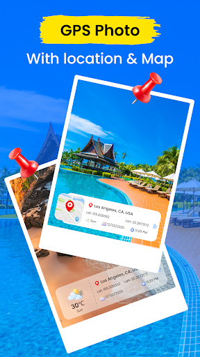
Capture photos with GPS location, geotags & compass direction
Take control of your photo memories with GPS Camera Map & Geotag Photos — the smart camera app that adds GPS location, coordinates, and more to every picture you take!
📸 Main Features:
GPS Photo Camera: Automatically embed your current location, GPS coordinates (latitude, longitude), and time into your photos.
My Location: View and save your exact location with map and address data when taking pictures.
Add Location to Photos: Manually add or edit the location tag of your images — perfect for organizing travel albums or field reports.
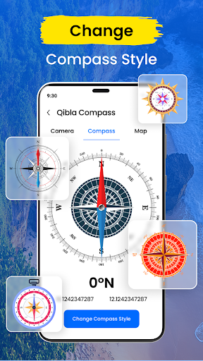
🧭 Extra Features:
Qibla Compass: Instantly find the direction of Qibla no matter where you are in the world.
Templates Library: Choose from customizable templates to add timestamp, location, and watermark to your photos in a stylish way.
Whether you're a traveler, field worker, or simply love organizing your photos with accurate data, this app makes geotagging seamless and fast.
✅ Ideal for:
Travel documentation
Field research & surveys
Real estate photography
Daily journaling
Sharing precise photo locations on social media
Download GPS Camera Map & Geotag Photos now and start capturing moments with context!