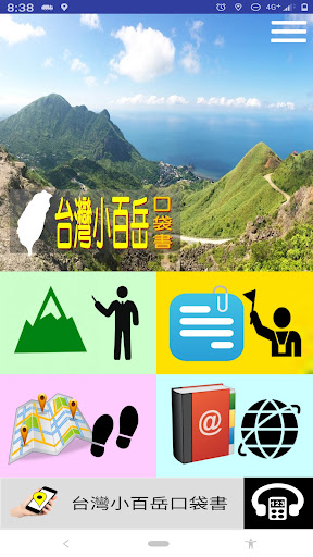
台灣小百岳口袋書
台灣小百岳口袋書 Summary
台灣小百岳口袋書 is a ad-supported Android app in Travel And Local by Guide Plus @Taiwan. Released in Sep 2022 (3 years ago). It has about 1.1K+ installs Based on AppGoblin estimates, it reaches roughly 44 monthly active users and generates around $<10K monthly revenue (0% IAP / 100% ads). Store metadata: updated Aug 31, 2025.
Recent activity: 6.00 installs this week (20 over 4 weeks) showing below average growth View trends →
Store info: Last updated on Google Play on Aug 31, 2025 .
0★
Ratings: 0
Screenshots

App Description
A practical mobile application that collects Xiaobaiyue information, you can check it at any time, and enjoy the fun of mountaineering
A practical mobile app that collects and organizes a wealth of information about Taiwan's Xiaobaiyue (Little Hundred Peaks)
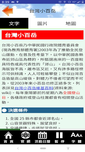
Xiaobaiyue is a popular outdoor activity in Taiwan. While there are numerous blogs and information about it, most of them consist of lists of Xiaobaiyue (Little Hundred Peaks) and basic mountain information, such as their heights. This information is supplemented by numerous blogs and videos. Therefore, we've compiled and developed a practical Xiaobaiyue pocket app that allows you to easily access and plan your hikes, allowing you to enjoy a pleasant hike. We hope this will be helpful to fellow hikers and provide a deeper understanding of the mountains.
Software Features
--Developed on a mobile navigation application platform, this software operates in a non-web-based mode for convenient and practical use.
--Download and update data once for smoother browsing.
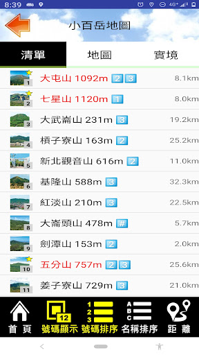
--Mobile map of the "Little Hundred Peaks" (including navigation and location tracking).
--Real-world directions to see if there are any nearby "Little Hundred Peaks."
--Notes (★) for "Little Hundred Peaks" you've visited or want to visit will be displayed as red bars.
--A list showing triangulation points (including base points and forest points) and their altitudes.
--Provides hiking reference points for some peaks, such as trailheads.
--Voice-assisted reading of mountain information while on the go.
--Share useful blogs and videos collected by the developer.
Functional Description
--Text explanations and operation.
--Photo album-style browsing.
--Text captions for photos.
--Voice explanations.
--Scenic spot list and real-world directions. VR)
--Sights sorted by name and distance
--Map reference marking (primarily marking trailheads)
--Users can mark key points
--Auto-play audio and photo playback options
--Google Maps integration for location and navigation
--Map marking (e.g., restrooms, parking lots, etc.)
--Switchable map modes between standard and satellite (landscape)
--720-degree real-time navigation (selected content)
--Practical digital audio guide function
--Categorized links to related blogs, websites, videos, etc.
--Overall interface font size settings
--Text browsing font size adjustment
--Adaptive interface based on the user's phone language setting
--Function keys for frequently used URLs
--Updates are downloaded once to save bandwidth and ensure smooth navigation
Permissions
--Background location permissions: This app accesses your current location only for the purpose of providing navigational information about nearby locations, displaying your current location relative to attractions on a map, providing navigation, and supporting real-time distance guidance. This access continues even when the app is closed or not in use. This location information is not transmitted or used for other functions.
--Photo Permission: This app downloads photos and data for offline use, reducing cloud usage and enabling smoother navigation by accessing data from your phone.
--Camera Permission: This app provides AR location tracking for viewing attractions through the camera.