LaserSoft Connect
LaserSoft Connect Summary
LaserSoft Connect is a mobile Android app in Maps And Navigation by LaserTech. Released in Oct 2024 (1 year ago). It has about 382+ installs Based on AppGoblin estimates, it reaches roughly 34 monthly active users . Store metadata: updated May 13, 2026.
Recent activity: 6.00 installs this week (23 over 4 weeks) showing steady growth View trends →
Store info: Last updated on Google Play on May 13, 2026 .
0★
Ratings: 0
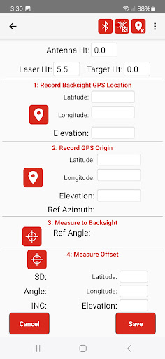
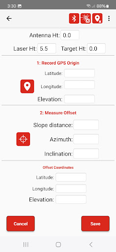
Screenshots


App Description
Enables laser offsets in Esri's Field Maps app, using any GPS provider.
Are you an Esri Field Maps user? Bring any GPS equipment to your project and use LaserTech's Connect app to enable offsetting your features location using one of our patented TruPulse lasers. Utilize one of three efficient workflows to position the laser and make the measurements to your feature. You can even record accurate elevations and object heights with the TruPulse.