

MAPOG Summary
MAPOG is a free, with in-app purchases Android app in Productivity by Engineer Philosophy. Released in Feb 2025 (1 year ago). Store last updated Feb 7, 2025
MAPOG SDKs Summary
App not yet scanned for SDKs.
0★
Ratings:
Screenshots


App Description
MAPOG – AI-Powered GIS & Location Insights - Create Interactive Story
🌍 AI-Driven GIS Mapping, Location Intelligence, and Spatial Data Analytics
MAPOG is a next-generation AI-powered GIS platform that allows businesses, marketers, real estate professionals, urban planners, and data analysts to leverage geospatial intelligence for smarter decision-making.
From vector data uploads (Shapefile, KML, GeoJSON) to advanced GIS tools like spatial queries, buffer analysis, and territory design, MAPOG delivers high-performance geospatial solutions with an intuitive interface and cutting-edge AI automation.
Powered by AI-driven analytics, MAPOG offers seamless geospatial data processing, visualization, and analysis.
🔥 Key Features & Functionalities
🧠 AI-Powered Search & Spatial Intelligence
✅ AI-Driven Location-Based Search – Automatically fetch, analyze, and suggest optimal locations.
✅ AI-Enhanced Business & Customer Insights – Identify profitable locations based on geospatial data.
✅ Geospatial Data Auto-Fetching – AI agents dynamically retrieve and validate location data.
📍 Comprehensive GIS & Mapping Tools
✅ Vector Data Upload & Management – Upload & manage Shapefile (.shp), KML, GeoJSON, and CSV.
✅ Real-Time Vector Tile Serving
✅ Custom GIS Layers & Styling – Visualize multiple geospatial datasets
✅ High-Speed Spatial Queries
✅ Custom SVG & SDF Icons for Dynamic Markers – Personalize map markers with scalable, color-changing icons.
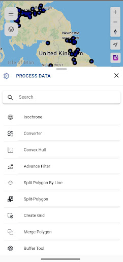
🛠 Advanced Spatial Analysis & Geoprocessing Tools
✅ Buffer Analysis – Create impact zones around points, lines, or polygons.
✅ Proximity Analysis – Find nearest locations using spatial distance queries.
✅ Overlay & Intersection Analysis – Identify overlapping regions between different datasets.
✅ Clipping & Merging – Extract and merge spatial features for in-depth analysis.
✅ Heatmaps & Density Mapping – Visualize hotspots with data-driven heatmaps.
✅ Geofencing & Spatial Alerts – Automate location-based notifications and alerts.
📊 Business Intelligence & Location Analytics
✅ Customer Mapping & Lead Tracking – Manage leads with real-time geolocation insights.
✅ Sales & Territory Optimization – Assign, optimize, and manage sales regions dynamically.
✅ Site Selection & Business Expansion – Identify high-potential areas for investment.
✅ Real Estate Property Insights – AI-driven data