Paddle Ways - Lets Go Paddling
Paddle Ways - Lets Go Paddling Summary
Paddle Ways - Lets Go Paddling is a with in-app purchases Android app in Maps And Navigation by onwater llc. Released in Jun 2023 (2 years ago). It has about 46.5K+ installs and 328 ratings with a 3.92★ (average) average. Based on AppGoblin estimates, it reaches roughly 3.3K monthly active users and generates around $<10K monthly revenue (100% IAP / 0% ads). Store metadata: updated Jun 5, 2026, version 632.
Recent activity: 684 installs this week (1.9K over 4 weeks) showing steady growth , and 2.00 new ratings this week View trends →
Advertising: AppGoblin detected 1.00 monetized ad creatives shown inside the app.
Data tracking: SDKs and third-party integrations were last analyzed on May 20, 2026. The app's network data flows (API traffic to/from the app and its SDKs) were last crawled on Jun 23, 2025.
Store info: Last updated on Google Play on Jun 5, 2026 (version 632).
SDKs, Trackers & Permissions
Paddle Ways - Lets Go Paddling was last scanned for SDKs 2026-05-20. Below is the overview of third party companies detected in the app. The full list of raw SDKs, app permissions and unknown SDKs is available here.
AppGoblin saw Paddle Ways - Lets Go Paddling uses 13 Development Tools
AppGoblin saw Paddle Ways - Lets Go Paddling uses 3 Business Tools
AppGoblin saw Paddle Ways - Lets Go Paddling uses 3 Analytics: Product
AppGoblin saw Paddle Ways - Lets Go Paddling uses 2 Analytics: Attribution
AppGoblin saw Paddle Ways - Lets Go Paddling uses 2 Ad Networks
App Details
App Store
Ads & App-Ads.txt
AppGoblin SDK Scans
3.92★
Ratings: 328
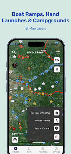
Screenshots


App Description
River & Lake Maps, Conditions
Paddle Ways: Your Ultimate Whitewater, Kayaking, Rafting, SUP and Canoe App
NOW with nationwide coverage of rivers and access points.
PaddleWays is your indispensable digital guidebook and GPS navigation tool for whitewater adventures. Whether you're kayaking, rafting, canoeing, or stand-up paddling, PaddleWays has you covered. Developed in collaboration with American White Water, this app delivers crucial information to ensure safe and informed decisions before you hit the water.
Discover Exciting Paddling Locations
Explore new rivers and sections, near and far, through interactive maps. Dive into guidebook descriptions, match your skill level with provided difficulty ratings, and connect with related resources for comprehensive insights.
Effortless Planning
Plan your perfect outing with confidence using PaddleWays. Measure river miles, access thousands of points of interest like access points, boat ramps, campsites, and more. Bookmark your favorite rivers, check real-time weather, and river flow rates (CFS) by location to find the ideal time for your adventure.
Seamless Navigation
Navigate with ease using detailed interactive 2D and 3D maps, available online and offline. Choose from Satellite, Outdoor, and Street map modes, measure distances in river miles, and set location-based alerts for upcoming take-outs, camps, or rapids.
Connect with the Paddling Community
Stay in the loop with user comments on recent conditions, and reference notes, photos, and saved places from previous trips. PaddleWays is not just an app; it's an interactive atlas and community forum designed for paddlers, by paddlers.
Who is PaddleWays?
PaddleWays is powered by NRS, dedicated to making human-powered recreation more accessible, safe, sustainable, and enjoyable. With technology developed by onWater, PaddleWays donates 1% of sales to promote responsible use and resource conservation.
PaddleWays Plus
Unlock premium features with a PaddleWays Plus subscription, including offline maps, river guidebooks, real-time flow data, and public & private land data.
Discover the ultimate tool for your whitewater, kayaking, and rafting adventures. Download PaddleWays today and explore the waters like never before.
USGS, go, levels, flow, white water, whitewater, weather, kayaking, rafting, raft, boat, canoe