Geo Position Tracker
Geo Position Tracker Summary
Geo Position Tracker is a ad-supported Android app in Tools by Pioczy. Released in Oct 2020 (5 years ago). It has about 145+ installs Based on AppGoblin estimates, it reaches roughly 9.00 monthly active users and generates around $<10K monthly revenue (0% IAP / 100% ads). Store metadata: updated Apr 28, 2022.
Store info: Last updated on Google Play on Apr 28, 2022 .
0★
Ratings: 0
Screenshots

App Description
Position tracking application that help in planing and analyzing trips.
Position tracking application that help in planing and analyzing trips.
Position tracking works in the background so main application is only required to start tracking, then it can be closed and everything will be done automatically. Application does NOT upload position data anywhere. Position tracking data is stored within phone memory to calculate statistics and paint route on the map.
It is possible to add stop tracking marker that will automatically stop position tracking after it is reached. This can be done by dragging and dropping finish tracking marker (yellow flag) to the desired position in the preview window, while tracking is in progress.
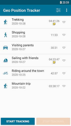
In the details view an additional note can be added to describe interesting facts about the trip. Such note will be presented as note icon in main view.
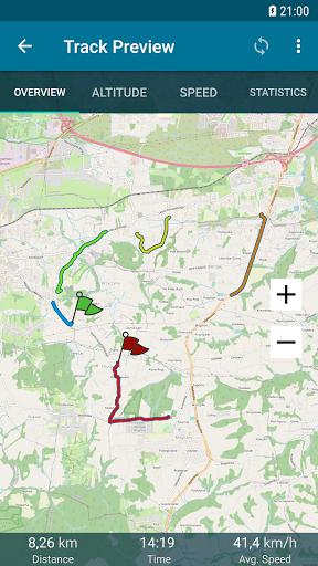
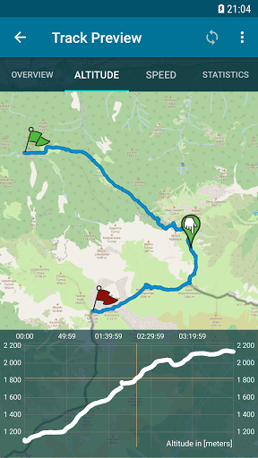
In preview window there are four tabs, Overview, Altitude, Speed, Statistics.
Overview contains general information about route. layout of this tab changes depending on tracking status. When tracking is enabled finish tracking marker and stop tracking button are visible.
Altitude tab shows altitude vs time graph it is possible to click points on the graph so corresponding position will be marked on the map.
Speed tab shows speed vs time graph and it is also possible to click points on the graph so corresponding position will be marked on the preview map.
Statistics tab contains several calculations that may be interesting for planning next trips.
It is possible to export tracking data to .gpx format.
In preview section user can use option 'Share' to generate overview image and share it with other people