Levee Inspection System 2
Levee Inspection System 2 Summary
Levee Inspection System 2 is a mobile Android app in Business by USACE Levee Inspection System. Released in Mar 2024 (2 years ago). It has about 220+ installs Based on AppGoblin estimates, it reaches roughly 84 monthly active users . Store metadata: updated Apr 22, 2026.
Recent activity: 1.00 installs this week (44 over 4 weeks) showing steady growth View trends →
Store info: Last updated on Google Play on Apr 22, 2026 .
0★
Ratings: 0
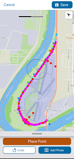
Screenshots


App Description
A levee data collection tool for the United States Army Corps of Engineers.
The Levee Inspection System 2 (LIS) is a comprehensive data collection tool for the United States Army Corps of Engineers (USACE) and its affiliates to conduct levee inspections throughout the nation. The tool assists inspectors with the processes of conducting inspections, collection observations and findings, and documenting flood or hazardous conditions. The data collected is then synced to the National Levee Database, which can be seen here https://levees.sec.usace.army.mil/#/, where it can then be analyzed, monitored, and used to generate reports and maps (available to authenticated users only).
There are thousands of levee segments and systems that can be used within the LIS. Each segment and/or system will have varying geospatial information that can then be seen on the built in map. Depending on the desired segment/and or system, some will have varying levels of data, which users can control in the in-app settings. The "NLD Features to Fetch" setting will limit how much data is getting pulled into the LIS. This will dynamically update the available "Segment Layers" list and legend on the map view allowing users to quickly see what information is available and can toggle them on/off to visually see more of the map.
While conducting inspections in the LIS, the app will display this information in the headers so you can easily distinguish which inspection you are working on.