UTM Measure
UTM Measure Summary
UTM Measure is a ad-supported, with in-app purchases Android app in Maps And Navigation by Y2 Tech. Released in Apr 2020 (6 years ago). It has about 77.6K+ installs and 2.1K ratings with a 4.35★ (good) average. Based on AppGoblin estimates, it reaches roughly 2.4K monthly active users and generates around $<10K monthly revenue (39% IAP / 61% ads). Store metadata: updated May 21, 2026, version 93.
Recent activity: 309 installs this week (782 over 4 weeks) showing steady growth , and 22 new ratings this week View trends →
Data tracking: SDKs and third-party integrations were last analyzed on May 6, 2026. The app's network data flows (API traffic to/from the app and its SDKs) were last crawled on Nov 20, 2025.
Store info: Last updated on Google Play on May 21, 2026 (version 93).
SDKs, Trackers & Permissions
UTM Measure was last scanned for SDKs 2026-05-06. Below is the overview of third party companies detected in the app. The full list of raw SDKs, app permissions and unknown SDKs is available here.
App Details
App Store
Ads & App-Ads.txt
AppGoblin SDK Scans
4.35★
Ratings: 2.1K
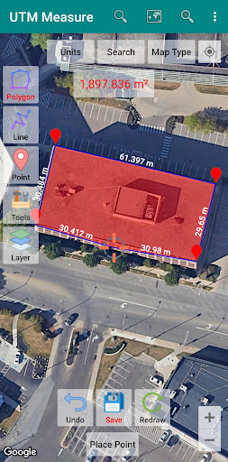
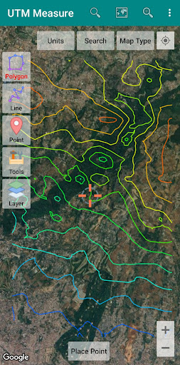
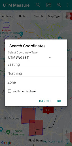
Screenshots

App Description
Tools for Simple GIS, Mapping and Surveying tasks.
Measure area and distance, register points, lines and polygons from Satellite Imagery map data or GPS data, perform simple spatial analyzes such as overlays, buffering etc.
Equipped with sophisticated spatial drawing & editing tools such as snap nearest, cutting / dividing polygons with lines, smoothing, reducing vertices using Douglas Peucker's algorithm, editing vertices of lines / polygons, combining 2 lines / joints, turning lines into polygons, polygons into lines etc. .
Make a contour line (premium).
Store unlimited amount of data in your local database including feature name information, photos, labels / notes, etc.
Export your data to KML, DXF or CSV files.
Working with Coordinate Reference Systems around the world from Minna Datum (Nigeria) to TM-3 (Indonesia), plot your polygons on a map based on coordinate data from various local CRS using EPSG Code.
Supports WMS (Map Server).
Any suggestions are welcome, please send via email to y2inatech@gmail.com or write a review. thanks.