RiverApp - River levels
RiverApp - River levels Summary
RiverApp - River levels is a ad-supported, with in-app purchases Android app in Weather by Florian Bessière. Released in Sep 2013 (12 years ago). It has about 515.3K+ installs and 4.8K ratings with a 4.73★ (excellent) average. Based on AppGoblin estimates, it reaches roughly 11.4K monthly active users and generates around $<10K monthly revenue (52% IAP / 48% ads). Store metadata: updated Apr 24, 2026.
Recent activity: 1.8K installs this week (5.6K over 4 weeks) showing steady growth , and 56 new ratings this week View trends →
Data tracking: SDKs and third-party integrations were last analyzed on Apr 8, 2026.
Store info: Last updated on Google Play on Apr 24, 2026 .
SDKs, Trackers & Permissions
RiverApp - River levels was last scanned for SDKs 2026-04-08. Below is the overview of third party companies detected in the app. The full list of raw SDKs, app permissions and unknown SDKs is available here.
AppGoblin saw RiverApp - River levels uses 7 Development Tools
AppGoblin saw RiverApp - River levels uses 2 Business Tools
AppGoblin saw RiverApp - River levels uses 1 Ad Networks
AppGoblin saw RiverApp - River levels uses 1 Analytics: Product
App Details
App Store
Ads & App-Ads.txt
AppGoblin SDK Scans
4.73★
Ratings: 4.8K
Screenshots


App Description
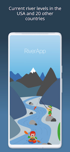
The most used App for checking river levels in the USA and the world
Get quick access to the latest water levels and river flows for rivers in the USA and 20 other countries around the world.
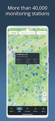
RiverApp is the application that contains data from the largest number of hydrometric stations in the world, with over 40,000 sites.
RiverApp is the ideal application for all river-related sporting or professional activities: kayaking, canoeing, pack rafting, stand-up paddling, fly fishing, river surfing, hydroelectricity, irrigation, etc.
It's also very useful for monitoring the evolution of rivers in the event of flooding.
FREE FEATURES:
‣ Current water levels and flows in over 15,000 rivers in the US and around the world.
‣ Water temperatures.
‣ Detailed maps of hydrometric stations and whitewater sections.
‣ Configuration of personalised alerts for each station when it has reached a defined value.
‣ Add stations or whitewater sections to favourites for immediate access to the latest readings and conditions.
FREE AND SPECIFIC FEATURES FOR WHITEWATER SPORTS:
‣ More than 4000 referenced whitewater courses.
‣ Display of the navigability of courses according to water level or flow.
‣ Precise mapping of courses with quick access to put in and take out points.
‣ Display and publication of hazards (with photos) on routes.
‣ Information on the difficulty, length and average gradient of whitewater sections.
‣ Addition and modification of whitewater courses by the user community.
ADDITIONAL FEATURES WITH "RIVERAPP PREMIUM":
‣ History of water levels and flows up to several years back.
‣ Flow or water level forecasts at certain stations.
‣ Display and comparison of satellite images on maps from several providers.
SOURCES:
- NVE
- California Data Exchange Center
- Government of Canada (Wateroffice)
- USGS
- NOAA
- PEGELONLINE (www.pegelonline.wsv.de)
- HVZ Baden Württemberg
- HDN Bayern
- Kanton Bern
- Ennskraftwerke
- Land Kärnten
- Land Niederösterreich
- NVE
- Regione Piemonte
- HVZ RLP
- Český hydrometeorologický ústav
- HVZ Sachsen-Anhalt
- Land Salzburg
- Scottish Environment Protection Agency
- Slovak hydrometeorological institute
- Agencija Republike Slovenije za okolje
- HWZ Steiermark
- BAFU
- HNZ Thüringen
- Land Tirol
- Shoothill
- Vigicrue
- Serveur de données hydrométriques temps réel du bassin Rhône Méditerranée
- L