Kadastr UA
Kadastr UA Summary
Kadastr UA is a ad-supported, with in-app purchases Android app in Maps And Navigation by QS_mobi. Released in Jul 2020 (5 years ago). It has about 400K+ installs and 1.3K ratings with a 2.33★ (poor) average. Based on AppGoblin estimates, it reaches roughly 17.9K monthly active users and generates around $<10K monthly revenue (32% IAP / 68% ads). Store metadata: updated Feb 12, 2026.
Recent activity: 240 installs this week (1.2K over 4 weeks) showing steady growth , and 1.00 new ratings this week View trends →
Store info: Last updated on Google Play on Feb 12, 2026 .
2.33★
Ratings: 1.3K
Screenshots

App Description
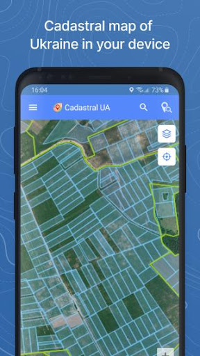
Kadastr UA — a mobile tool for viewing and analyzing land plot information
⚠️ This application is not an official government app. It is not affiliated with, endorsed by, or representing any government authority of Ukraine. All land parcel information displayed in the app is obtained exclusively from the official public source:
State Land Cadastre of Ukraine — https://e.land.gov.ua
The application only visualizes and organizes publicly available data from this source and does not provide any government services.
Main features:
- View land parcel boundaries on the map
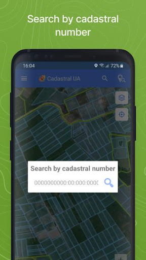
- Search parcels by cadastral number
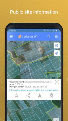
- View publicly available parcel attributes (area, land use purpose, location)
- Save favorite parcels
- Access search history
- Share cadastral numbers via messaging apps or email
Access and additional features
Full functionality is available after login. Authorization is available for registered users of Soft.Farm or Kadastr.UA platforms.
After logging in, users may access additional analytical tools, including:
- Comparing parcel boundaries with cultivated fields
- Monitoring lease expiration dates
Displaying publicly available information from official open state registries (only if such information is available within the State Land Cadastre source)