Altimeter
Altimeter Summary
Altimeter is a ad-supported, with in-app purchases Android app in Tools by PixelProse SARL. Released in Oct 2019 (6 years ago). It has about 1.9M+ installs and 22.1K ratings with a 4.62★ (excellent) average. Based on AppGoblin estimates, it reaches roughly 46.6K monthly active users and generates around $<10K monthly revenue (41% IAP / 59% ads). Store metadata: updated May 11, 2026.
Recent activity: 4.3K installs this week (14.8K over 4 weeks) showing steady growth , and 18 new ratings this week View trends →
Data tracking: SDKs and third-party integrations were last analyzed on Apr 22, 2025.
Store info: Last updated on Google Play on May 11, 2026 .
Altimeter was last scanned for SDKs 2025-04-22. Below is the overview of third party companies detected in the app. The full list of raw SDKs, app permissions and unknown SDKs is available here.
4.62★
Ratings: 22.1K
Screenshots

App Description
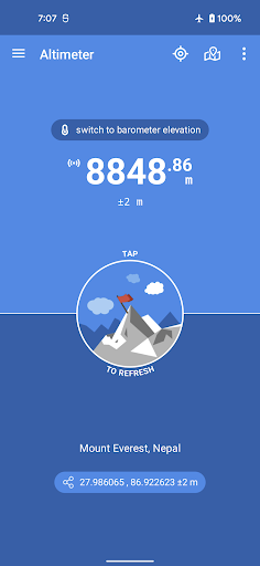
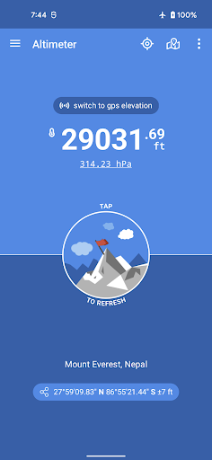
The most precise Altimeter for offline true altitude above sea level (MSL).
Altimeter is an handy Android application allowing you to get the true altitude above sea level (MSL) at your current location or any location on earth. It requires access to your device location to get raw altitude from the GPS signal and do not require a network connection to work. True altitude above mean sea level is determined using EGM96 Earth Gravitational Model. Main features are :
• Offline true altitude above sea level
• No network required (works offline and in flight mode)
• True altitude above sea level (AMSL using EGM96)
• Ordnance Survey National Grid reference system (OSGB36)
• Use Barometer or GPS Satellite
• Address at current location
• Save altitude at location
• Altitude accuracy estimation
• Horizontal accuracy estimation
• Altitude at any location
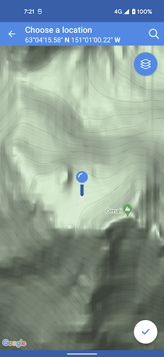
• Pick location on a Map
• Open photo geotags to display associated altitude
• Search for a location by name or address
• Universal Transverse Mercator coordinates (UTM)
• Military Grid Reference System coordinates (MGRS)
• Home screen widget to display altitude at current position
Network access is required to get the altitude of a location picked from the map.
Height above mean sea level (AMSL) is the elevation (on the ground) or altitude (in the air) of an object, relative to the average sea level datum. Normal GPS elevation considers the entire Earth as an ellispoid and differences up to 100 metres (328 feet) can exist between this ellipsoid height and true mean tidal height. The alternative, which is what we use in this application, is a geoid-based vertical datum such as the global EGM96 model.
Altitude vertical accuracy is defined at 68% confidence. Specifically, as 1-side of the 2-sided range above and below the estimated altitude reported, within which there is a 68% probability of finding the true altitude.
Enjoy!