Utah County Parcel Map
Utah County Parcel Map Summary
Utah County Parcel Map is a mobile Android app in Tools by Utah County Government. Released in Oct 2012 (13 years ago). It has about 10.9K+ installs and 69 ratings with a 3.75★ (average) average. Based on AppGoblin estimates, it reaches roughly 947 monthly active users . Store metadata: updated Sep 22, 2025.
Recent activity: 24 installs this week (62 over 4 weeks) showing steady growth View trends →
Store info: Last updated on Google Play on Sep 22, 2025 .
3.75★
Ratings: 69
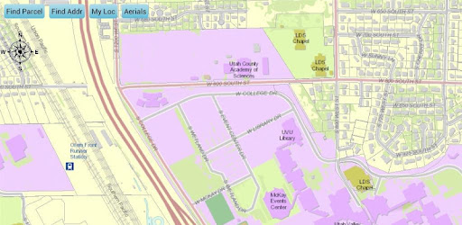
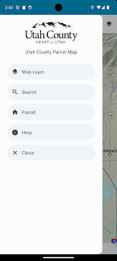
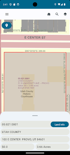
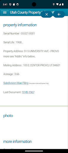
Screenshots
App Description
Discover parcel info, values, dimensions, and parcel history with a simple touch
Utah County Parcel Map provides simple easy to use tools to assist you in understanding parcels and parcel ownership in Utah County. You will find an easy to use address search that will zoom the focus of the map to the corresponding address. There is also a parcel identification number search that allows the user to search for parcels by their serial number. There is also a name search that allows a user to search for parcel by owners name.
As the user zooms in closer and closer to a parcel, more data will be displayed on the map. Eventually, dimensions, descriptions, measurements, and boundaries will become clear to the user for each parcel in the county.
Information specific to each parcel comes up in a convenient call-out box when the user “clicks” on the screen.
"Mapping API provided by Esri ArcGIS Runtime API for Android"
Esri ArcGIS Online provides the World_Street_Map and World_Imagery web services used in this app.
World_Street_Map Sources: Esri, DeLorme, NAVTEQ, USGS, Intermap, iPC, NRCAN, Esri Japan, METI, Esri China (Hong Kong), Esri (Thailand), TomTom, 2012
World_Imagery Sources: Esri, DigitalGlobe, GeoEye, i-cubed, USDA, USGS, AEX, Getmapping, Aerogrid, IGN, IGP, and the GIS User Community