Geology Record
Geology Record Summary
Geology Record is a ad-supported Android app in Tools by Hungwen Chen. Released in Jun 2019 (7 years ago). It has about 3.2K+ installs Based on AppGoblin estimates, it reaches roughly 105 monthly active users and generates around $<10K monthly revenue (0% IAP / 100% ads). Store metadata: updated Oct 13, 2019.
Store info: Last updated on Google Play on Oct 13, 2019 .
0★
Ratings: 0
Screenshots

App Description
A geological survey tool
A geological survey tool which is combined Google map with the following features:
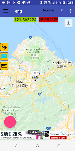
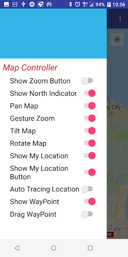
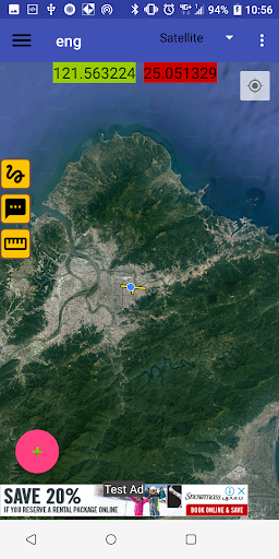
Map
* Real-time GPS location and change base map in several types.
*Display waypoint location and attitude information on the map. And the waypoint marker can be dragged freely to adjust the position.
*Overlay custom map, support 3 types of custom maps, including jpg, pdf, and mbtiles. And the custom map supports transparent adjustment.
*Track logging in GPX format.
*Distance measure.
Geology Record Table
*6 types of table: Lithology, Structure, Attitude, Description, Photos, and Sampling(including GSI strength).
*Lithology table: using spinner to speed up the input work.
*Structure table: lineation attitude can be calculated through two limbs of fold.
*Attitude table: attitude edit support multiple data sets, and can be edited by e-compass or manual input.
*Photo table: support mobile phone camera to save photo no. or manually input photo no. from an external camera.
*Sampling and GSI strength table: using GIS definition to record rock strength.
*Custom selection can be added into an assigned spinner and stored the setting in the project.
Slope Stable Analysis on Stereonet
*Drawing the stereo net projection according to the recorded attitudes.
*Drawing the unstable boundary of the wedge, planar, and toppling by input friction angle.
*Exporting the stereo net to jpg files.
Data Storage
*Data format is SQLite. All data saved immediately to prevent data loss.
*Recording data can export to text files with tab separator.