Compass & Altimeter

Compass & Altimeter Summary
Compass & Altimeter is a with in-app purchases Android app in Tools by PixelProse SARL. Released in Dec 2018 (7 years ago). It has about 9.9M+ installs and 122.6K ratings with a 4.44★ (good) average. Based on AppGoblin estimates, it reaches roughly 957.1K monthly active users and generates around $10K+ monthly revenue (100% IAP / 0% ads). Store last updated Jun 29, 2026
Recent activity: 6.3K installs this week (34.7K over 4 weeks) showing below average growth , and 30 new ratings this week View trends →
SDK intelligence: AppGoblin detected 4 development tools(e.g. Google), 2 ad networks, 1 analytics: product,and 1 mediation integrated into Compass & Altimeter. View full SDK list →
Compass & Altimeter SDKs Summary
Compass & Altimeter was last scanned for SDKs on 2026-06-22. Below is the overview of third-party companies detected in the app. The full list of SDKs, permissions and unknowns is available here.
4.44★
Ratings: 122.6K
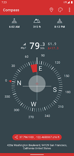
Screenshots


App Description
A Compass, with geographic north, true altitude, address, sunset & sunrise times
A simple and easy to use Compass to retrieve useful information about your current position such as true Geographic north and true altitude above sea level.
• Works perfectly offline and without network access
• Geographic north using magnetic declination
• True altitude above mean sea level (AMSL)
• Sunrise & Sunset times
• Azimut angles in deg, grad, mrad, gon
• Various dials and color themes (including high contrast)
• Angle measurement (with dials including measuring capabilities)
• Bubble Level functionnality (available in iPhone dial)
• Use EGM96 as the geoid reference for computing altitude
• Latitude & Longitude in MGRS, UTM coordinate formats
• Latitude & Longitude in DD, DMM or DMS format
• British National Grid (OSGB86) coordinate system
• SwissGrid (CH1903 / LV95 / MN95)
• Magnetic field strength to detect potential perturbations
• Sensor accuracy
• Address of your current location (requires data connectivity)
Compass better works outside where magnetic perturbations are low. Magnetic closure cell phone cases may also disrupt the accuracy of the compass.
EGM96 (Earth Gravitational Model) is used as the geoid reference to compute true altitude above sea level from data collected by the GPS sensor. UTM (Universal Transverse Mercator) is a system for assigning coordinates to locations on the surface of the Earth.
Have fun !