Drone-Spot
Drone-Spot Summary
Drone-Spot is a mobile Android app in Libraries And Demo by Sylvain Merieult. Released in Apr 2018 (8 years ago). It has about 105.7K+ installs and 1K ratings with a 3.92★ (average) average. Store metadata: updated Apr 30, 2026.
Recent activity: 196 installs this week (35.2K over 4 weeks) showing above average growth View trends →
Data tracking: SDKs and third-party integrations were last analyzed on Apr 10, 2026. The app's network data flows (API traffic to/from the app and its SDKs) were last crawled on Nov 17, 2025.
Store info: Last updated on Google Play on Apr 30, 2026 .
Drone-Spot was last scanned for SDKs 2026-04-10. Below is the overview of third party companies detected in the app. The full list of raw SDKs, app permissions and unknown SDKs is available here.
3.92★
Ratings: 1K
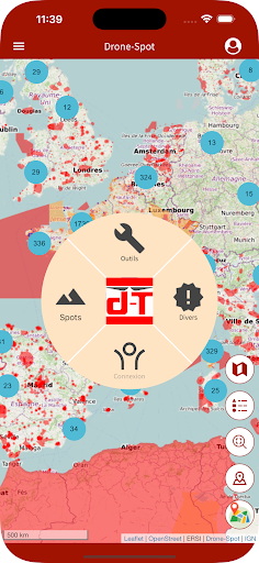
Screenshots


App Description
Find the perfect spot to fly your drone in an authorized space
Drone-Spot lists a large number of locations where you can fly your drone. Whether you're looking for a spot to shoot photos or videos, a spot to fly your recreational drone, FPV drone, or racing drone, Drone-Spot makes your search easier.
Through its community database, Drone-Spot offers a variety of spots while providing information on aviation regulations via the Géoportail map, which can be viewed directly on the spot's page. You'll also find other essential information: How to access the spot, sunrise and sunset times, weather information, the K index, and more.
This version 6 is designed to be more user-friendly by improving and integrating new features.
New version of Drone-Spot. We've taken your feedback into account.
Here are the new features:
- Smoother application,
- Improved menu,
- Redesigned mapping,
- New glossary,
- Updated documentation regarding applicable regulations,
- Ability to register equipment via barcode,
- Flight environment: built-up areas, nearby airfields with a link to the VAC,
- Weather with TAF & METAR forecasts,
- Flight history (Date/Time, GPS position, weather, etc.),
- AI trained on regulations regarding the recreational category,
- Improved PDF reader (zoom, print, etc.),
- Storage of administrative certificates (training, registry extract, insurance, etc.)
- And many other improvements.